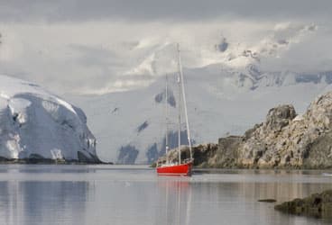
Melchior Island
Cleared out from Argentina, we’ve sailed to the eastern end of the Canal Beagle and anchored in a small cove to await decent departure weather. A day has passed. As the rain and gale-force gusts begin to diminish, Rolf asks me to order GRIBs showing surface pressure and wind prognoses for the next 10 days. His major interest is the forecast for the last two days of the 1,000-nautical-mile passage to South Georgia, when we’ll be sailing through ice-infested waters, because the band of ice constantly drifting past South Georgia has recently been fortified by the breakup of the Larsen Ice Shelf in the Weddell Sea.
The GRIB arrives. The wind prognosis for our E.T.A. in South Georgia is for gale- to storm-force northwesterlies. That wind is humid and creates fog. Poor visibility and heavy wind in an iceberg zone is worth avoiding. “It’s a good thing we have no schedule or feel any pressure to leave,” says Rolf. “We can wait and recheck the GRIBs tomorrow.”
Just as I’ve begun thinking how to spend an extra day at anchor, Rolf says, “Deborah, why don’t you order another 10-day GRIB? This time, please check out Drake Passage.”
I smile big. This is the first inkling of any intention to return to Antarctica—on Rolf’s part, that is. Many times I’ve voiced my desire to return to the Antarctic Peninsula, my favorite place on Earth. And I especially want to go to Hovgaard Island, where we lived from 1991 to 1992. To me, Hovgaard is home. I could barely stand the idea of being so close without visiting, but it was something I had to endure. Neither the South Shetland chain nor the Antarctic Peninsula is part of our subantarctic expedition.
I can hardly believe what’s happening. Rolf isn’t usually an impulsive person. While we await the new GRIB, I half expect him to withdraw the idea. But he doesn’t. The GRIB arrives, and I win the lottery! The prediction is for perfect weather in Drake Passage. There’ll be wind, but not too much. I tell Rolf that I don’t care if we spend just one day at Hovgaard before continuing to South Georgia; those 24 hours would be the best present ever. We weigh anchor and leave. It takes five days to cross Drake Passage. There’s less wind than forecasted. Neither of us gets as much as a splash on our foul-weather gear.
In the Shadow of a Hero
When we sailed to the Antarctic Peninsula in 1984 and again in 1991, there was an admission price to be paid: the possibility of icebergs starting at the Antarctic Convergence, and a guaranteed band of icebergs during the last 100 miles. Both times were scary. The visibility was poor, as it statistically tends to be. Because we had no radar in those days, there was no early warning of big bergs ahead. And because there was no alternative, we stood our watches on deck, no matter the conditions. Wet, freezing, staring out into the mist, we persevered, hoping to sight any berg or growler in time to rush back to the tiller, detach the wind steering, and hand steer around it.
If I’ve learned one thing over the years, it’s that being scared ahead of time isn’t worth it. These days, I’m a lot cooler; I don’t often get scared without reason. For this passage, it’s a good thing I didn’t bother conjuring phantom icebergs ahead of time. There was no reason whatsoever to give myself more gray hair. Not one berg was sighted offshore. Not even during the final approach to the South Shetlands. The first berg we saw was after we’d already sighted Clarence Island and Elephant Island. We found this lack of ice odd.
If coming to Antarctica is a gift to me, reaching Elephant Island is a gift to Rolf. Ernest Shackleton has been his hero since childhood, and he became a role model for Rolf’s style of leadership. Lucky me! Rolf makes my coffee in the morning, because whenever the going was tough, Shackleton would arise first in order to make hot chocolate and distribute it to his men. When Rolf and I met in 1980, he had a plan to do a documentary about “The Boss.” The plan changed, but that hardly dispelled Rolf’s desire to see Elephant Island, the place where Shackleton’s men waited for their leader to rescue them.
Rolf and I can hardly believe our continuing good luck with the weather. In calm, we motor around to the east side of the island, looking for the beach where the 22 men waited for four months. A more desolate place is hard to imagine. Elephant Island rises steeply out of the ocean; 95 percent of it is covered by glaciers. The few stone beaches are narrow and fringed with craggy black rocks. How those men kept their willingness to survive, let alone their sanity, while living in such a harsh place is beyond me. My appreciation of their resilience increases each and every minute that the island is in sight. As Northern Light draws close to Point Wild, where the men camped, the swell picks up. Waves begin breaking on the shoreline, making a dinghy landing impossible. We won’t be able to touch the site.
The swell is the forerunner of wind. On the northeasterly breeze that’s picking up, we set sail for King George Island. It’ll be an overnight passage, but never dark. The magic of the many-hours-long twilight, when the ice and snow is washed in pastel hues of pink and green, rekindles my love for this “white” continent.
King George Island, the biggest in the South Shetland chain, hums with human activity. The stations of many countries are sprinkled over the entire south coast: Polish, Brazilian, American, Argentine, German, Korean, Chinese, Chilean, Russian, and Uruguayan. Within walking distance are rescue huts erected by other countries. Each country’s presence is in part a way to lay a claim in Antarctica, though for the time being, every signatory of the Antarctic Treaty has agreed to suspend all territorial claims.
“Despite the treaty, the jockeying continues,” an Argentine tour guide once explained to us. “The Chileans brought families to their stations, to prove settlement. We Argentines brought newlyweds, giving them their own honeymoon quarters and keeping them there until birth provided us with the first true Argentine-Antarctic citizen. And the English?” He paused and shrugged his shoulders to show his incomprehension of the non-Latino mentality. “The English chose to open a post office. . . .”
The Wind Tunnel
Continuing west along Nelson Island, we glide past glaciers and snow fields with meringue-like cornices only to enter another world at the Aitcho Islands. Each island in the Aitcho group is small and low. They’re basically free of snow in the summer, their slopes moss covered. It hardly looks like Antarctica.
On the largest island in the group, at a site visited by cruise ships, we have an encounter with penguin chicks accustomed to people. The chicks are old enough to be left on their own, but for safety they stay bunched together in what’s called a crèche. As I sit in a 25-yard no-man’s land between two gentoo rookeries, an entire crèche approaches. The dozen downy chicks take turns pecking at my boots, my pant legs, my sleeves, and my camera, and finally one crawls into my lap! During our year at Hovgaard, no close encounter like this ever happened at the gentoo rookery there.
On the first of February, the mild weather pattern we’ve enjoyed for a month is disintegrating. We’re always on alert for a major weather shift like this, whether it’s a low-pressure area nudging against a high or vice versa. In either situation, where the systems’ isobars meet, both circulate air in the same direction. These neighboring isobars form what’s called a “squash zone,” an area in which the winds tend to be greater than the spacing of the isobars would indicate.
We figure that under the influence of the approaching series of lows, the South Shetlands will regain their normal status as a very windy place. The first low in the series is a monster, covering 20 degrees of latitude, a diameter of 1,200 nautical miles! I fear we’ll split at the seams as the barometric pressure drops continuously for a week, from 1,006 millibars to 968.
We keep an eye on the GRIBs and get the Chilean surface analysis and prognosis via weatherfax and wind predictions via the voice broadcasts. When an Argentine military vessel anchors near us, I hail the crew over the VHF and ask for their forecast. All the information indicates that by the time the depression reaches our position, the pressure should be rising, with the gale-force wind diminishing. The only confusing bit is that the Argentines forecast southerly wind, opposite to what we expect. Are they wrong? We think so, but should we ignore their forecast? We decide not to, so we leave the west side of Half Moon Island, where we have good holding but no shelter in southerly wind, and move five miles upwind, back to Yankee Harbor, on Greenwich Island, one of the safest anchorages in the South Shetlands. The bay, nearly enclosed, has an outer flank formed by a curved gravel bar, and we’ve found good holding there in clay. Snug as a bug.
With the Argentine forecast in mind, we anchor in the southwest corner, where we’ve anchored before. Anchor down and engine in reverse, we increase the revs. Northern Light stretches the slack out of the chain, then just sits there. We’re happy. We have good holding, and in southerly wind, we’ll have perfect protection. If it does blow from the north, a pretty big chop will build in the one-mile fetch. In the predicted wind speed, it’ll be uncomfortable but not unsafe.
The season is now six weeks past the summer solstice, and nighttime has returned. During the wee hours, a northeasterly wind pipes up. The noise of small wavelets wakes me, and I get up to stand watch. All I can see through the Plexiglas cupola is the wind indicator at the top of the mast, lit by the anchor light. Robbed of landmarks, I check the GPS “at-anchor” screen, on which the boat’s movements are drawn. The kidney bean-shaped pattern indicates that the anchor has holding. The arc represents the boat swinging with wind shifts, and the width of the bean is the result of back and forth movement due to changes in wind intensity.
The wind builds to full gale force, higher than forecasted. Rolf can’t sleep and joins me on watch. So far, all’s well. Even though we set the anchor for the opposite wind direction, we have holding. The wind continues to increase. It’s blowing about 60 knots when a real shrieker envelops us. It gives me goose bumps. The boat starts drawing a straight line on the GPS screen. We’re dragging. Toward the gravel bar.
Rolf starts the engine, and as it warms up, we quickly don foul-weather gear. After dragging 20 or 25 yards, the anchor holds. But the rail is often underwater, and the wind isn’t decreasing. Even though we still have swinging room, having our tail toward a lee shore doesn’t feel good. I go out ahead of Rolf, leave the cockpit, and crawl forward, my foul-weather jacket flogging like a blown-out sail.
At the controls in the cockpit, Rolf starts powering Northern Light forward, doing all he can to hold the bow into the wind, while on the foredeck I push the button to bring up the anchor. Trying to talk or scream to each other is meaningless. Using hand signals, I let him know when to pause and when to power forward. Rain and sleet fly horizontally in 70 to 80 knots of wind, waterblasting my face until it gets too numb from wind chill to feel anything.
Anchor up, we motor slowly against the waves toward a GPS anchor waypoint in the northeast corner of the harbor, close to the 50-yard-high glacier wall. In its shelter, there’s hardly any wind. But from our previous time here, we know that this wall is very active, calving bergy bits by the ton. Unfortunately, the leaning ice pillar that had us worried last time is still standing. When that pillar falls, it’ll create a swell that could force us up onto the rocky shoreline on our starboard side. Talk about being between a rock and a hard place.
By 0800, the wind has diminished to gale force. We get a new surface analysis showing that the wind we experienced overnight wasn’t created by the monster low but by an unpredicted one that formed just northwest of us. The tight little spinner has a front that forms three-quarters of a circle around its center. The eastern part of it passed us during the night; now its western part is coming.
No sleep for us. We’re going to get clobbered again. The wind builds, probably to 70 knots. We know it’s over 60 because we can see the gusts chisel the surface off the water, creating walls of spray as high as our mizzen mast. There’s been a wind shift. The low clouds fly in the new direction. But the local land contour reroutes the wind. The net result is no change for us; the ice wall still shelters. The blow lasts an hour and a half. The anchor holds.
Nature in the Balance
When we were here in 1984, we found no holding close to the glacier wall. Back then, the bottom was rocks and boulders of varying sizes. The anchor chain made terrible scraping noises as it moved against them. Today, in contrast, there’s no noise because the bottom has been covered in clay. During our visit to a station on King George, a glaciologist gave us this explanation: Sediment layers in the glacial-walled bays have increased due to the recent acceleration in glacial melting.
After six weeks in the South Shetlands, we’re ready to proceed southward along the Antarctic Peninsula. We wait for the Antarctic Bellows to pick up, the northeasterly wind that was predominant along the peninsula during our previous visits. We wait some more. It never makes an appearance. We leave against a headwind. It’s just as well. The Bellows, an inertial jet that’s set in motion by a high over the Weddell Sea, never shows up this season. It’s a major weather change most likely caused by the ice disappearing in the Weddell Sea. No ice means no stationary high. No high, no Bellows.
Going south, we anchor in places we know well. Some we can compare to pictures we took in 1984. Elsewhere, we compare the places to what we remember of them. Wherever we look, we see less glacial ice and snow cover. Finally, a bit of good news: We find Port Lockroy cleaned up. A British Antarctic Survey dog-sledder, unemployed when dogs were banned from Antarctica, came up with the idea of restoring the buildings in Port Lockroy. The site, abandoned in 1962 after 14 years of use as a British spy outpost disguised as a meteorological station, is now a museum, gift shop, and post office.
A major tourist destination, the museum attracts up to three cruise-ship visits a day. In response to the increased traffic, penguin behavior has changed here, too. Neither adults nor chicks pay the slightest attention to humans strolling past their nests. Leopard seals aren’t as accommodating. In the 1980s, leopard seals started puncturing the pontoons of inflatables moored outside Palmer Station. At Port Lockroy today, a huge female has taken to swimming after cruise-ship inflatables and biting holes in them. One day, she attacked three. Much worse, another leopard seal recently pinned a diver, then pushed her deeper until she drowned. This is the first time a leopard seal has killed a human.
Home Is Where the Heart Is
On a windy, snowy, low-visibility day, we finally reach Hovgaard Island. Standing on a hill next to our winter-over anchorage, I turn 360 degrees to reacquaint myself with the magnificent alpine scenery. As the exhilaration of arrival wears off, it dawns on us how dramatically the landscape has changed. There’s a lot less snow and ice than when we left in the summer of 1992. And the snow line is much higher. “Look, Rolf,” I say pointing across the bare rocks. “That pool over there stayed frozen when we were here. And the area around it was always snow covered. We skied here year-round!”
Rolf doesn’t answer me right away. He closes his eyes and shakes his head slowly in disbelief. Then he remarks softly, “Remember what an issue drinking water was for us? Well, no one needs to melt snow or ice any more.” I touch his arm, and we both turn our gaze to the melt water running in rivulets and streams down the rocks.
Neighboring Pléneau Island is also remarkably different. Its south side used to slant toward sea level, and the slant provided ice caves to examine and ice walls to climb. That face is now vertical. Our playground has evaporated, as have the snowcaps on the small adjacent islets. Ditto on the west side of Pléneau. Two ice tongues that slanted away from the top and had provided ski access are now gone. These changes represent the loss of millions of cubic yards of snow.
After scouting around the island group, we realize that both animal and bird life have changed substantially. The gentoo-penguin population has exploded. The rookery that covered a corner of the island now rings 50 percent of the coast. And due to less snow cover, gentoos now nest on rocky areas and at higher altitudes than before. In contrast, the cormorant colony has dwindled, and although the few remaining adult birds look healthy, their nests are of remarkably poor quality, compared with those we saw last time. And their chicks are in poor shape. No surprise; they beg and beg for food, yet remain unfed. The skua population must have quadrupled; they nest all over the newly exposed rocks. Additionally, there are fewer elephant seals hauled out, but more fur seals. And the biggest surprise: There’s moss growing on the islands’ northern slopes! It hits us that the Antarctic Peninsula has started to resemble the South Shetlands of 15 years ago.
Back then, when we wintered at Hovgaard, we sent observations to various scientists working at Palmer Station. When we now send an email to ecologist Bill Fraser describing the changes in bird populations, he replies that our observations parallel theirs and that, indeed, the recent changes in the state of the peninsula are staggering. He sums them up: glaciers retreating, ice shelves disappearing, air and water temperatures up, krill biomass down, Adélie penguin populations collapsing, cormorant and chinstrap penguin populations down, but gentoo penguin numbers increasing—up 6,000 percent near Palmer Station. The conclusion? The entire ecosystem along the Antarctic Peninsula is being transformed—from a polar to a subpolar one.
This voyage south, to a place we love, started as pure serendipity, an impulsive and precious gift from Rolf to me. On our last morning at Hovgaard, I’m awakened by a trilling noise, just as I was every winter’s day when this place was really my home. It’s a Weddell seal, just on the other side of Northern Light’s steel hull. I don’t know if it’s a call or just echo location. I do know that I find the trill, which starts high and ends low, hauntingly beautiful. It used to make me happy. Today, it’s a different kind of wake-up call. I break into tears.
Deborah Shapiro and Rolf Bjelke have been cruising together since 1982 on Northern Light_. Read the concluding chapter of Pearls Around the White Continent in an upcoming issue of_ Cruising World_. To read previous installments in this series, log on to CW’s website (www.cruisingworld.com/1010continents)._

