keeweenaw penn 368
Like fly-over country that coast-to-coast air travelers never see, the Keweenaw Peninsula, on the upper part of Michigan’s Upper Peninsula, is usually thought to simply get in the way of sailors cruising along Lake Superior’s south shore, an obstacle to be endured rather than a destination to explore.
My sister lives on the Keweenaw (pronounced KEY-wa-naw), and she’s boasted for years of the area’s rugged beauty and rich ethnic history. So my wife, Jennifer, and I decided to take Catamount, our Caliber 38, from our home base in Lake Huron’s southern Georgian Bay up to Lake Superior to see for ourselves.
The trip would offer us the chance to do a nautical improbability: completely circumnavigate a peninsula. Native Americans avoided going around the Keweenaw by taking a two-mile portage into a river and lake system that cuts through its middle. A ship canal dug in the 1860s enlarged this natural drainage into the Keweenaw Waterway. (While “Keweenaw” is the English spelling of the Ojibway name for “carrying place,” the Ojibway pronounce the name KEE-wen-EE, a lyrical reminder of their storytelling past.)
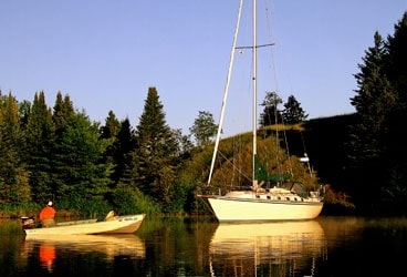
We sailed to the waterway’s east entrance and found a tidy anchorage in an old oxbow of the original river, where our only neighbors were blue herons and bald eagles. Fog settled in overnight, so in the morning we inched our way up the well-buoyed channel to Portage Lake, then groped our way to its north end, where the mining towns of Houghton and Hancock stare at each other across the waterway. A baby-blue lift bridge connects the two towns; its two-level span carries cars on top, but the freight trains on the lower level have been replaced by snowmobiles. The peninsula’s cold winters and lake-effect snowfalls are legendary.
The Keweenaw was formed over a billion years ago by lava flowing out of a rift in Earth’s crust, carrying huge amounts of copper to the surface. In the mid 1800s, the largest copper deposits in the world were discovered there, and historians credit Keweenaw copper as making America’s economic surge in the late 19th century possible. Think of all the copper in telephone and electricity lines, for example. The area is still known as “Copper Country,” but the ore is gone. The last of the mines closed in the 1970s.
It was in Houghton and Hancock that we first got a sense of the special identity of the area. Residents of the Upper Peninsula call themselves “Yoopers,” as in “U.P.ers.” They refer to residents of lower Michigan as “Trolls,” creatures who live beneath a bridge, the bridge in question being the five-mile long Mackinac Bridge, which connects the two parts of this water-blessed state. The U.P. comprises one-third of Michigan’s landmass but only 3 percent of its population, and it’s as wild an area as you can find in the Lower 48. How remote is it? NASA used the Keweenaw in the 1960s as a missile-testing range for its space program.
Houghton is the more cosmopolitan of the two towns, with a vibrant downtown, stunning 19th-century municipal buildings, and several waterfront parks. Michigan Tech University, originally created as a mining school, has a fascinating mineral museum, and may be the only school with a parking lot for students’ snowmobiles. No visit to Houghton is complete without a stop at the Keweenaw Brewing Company, a brewpub that serves such favorites as Pick Axe Blonde Ale and Widow Maker Black Ale to wash down the buckets of peanuts that accompany every pitcher of beer.
Hancock, across the way, is smaller and quieter, with an old ore crusher dominating its skyline, but it has a distinction no other city in the Western Hemisphere can claim: Its street signs are in English and Finnish. The copper mines in their 19th-century heyday attracted immigrants from all over Europe, but none had more impact than the doughty Finns. A local school, Finlandia University, still gets regular financial contributions from Finland.
In Hancock, we also stocked up on pasties, a meat pie of ground beef, potato, onion, and rutabaga (yes, rutabaga) baked in a folded crust that fits neatly into your hand. Pasties were brought to the area by miners from Cornwall, England, and today pasty shops still outnumber McDonald’s.
The fog lifted after a few days, allowing us to exit the west end of the waterway and turn east along the Keweenaw’s north shore. The forbidding palisades are reminiscent of Hawai’i, the lava cliffs broken only by iridescent black-sand beaches and dramatic red-sand beaches derived from hematite that accompanied the lava to the surface.
Our first stop was Eagle Harbor, its entrance marked by a lovingly maintained lighthouse built in 1871. We entered the totally protected harbor after threading our way through unmarked reefs, then docked at the long-deserted U.S. Coast Guard station. Nearby is a lovely white-sand beach, rare on the peninsula both for its color and its warm, swimmable water. The next day, we hitched a ride to the top of nearby Brockway Mountain, along whose summit meanders a scenic road reminiscent of the Skyline Parkway in the Blue Ridge Mountains; the Civilian Conservation Corps built both roads in the 1930s. From the summit, one could see Isle Royale to the north, some 40 miles away.
Then it was on to Copper Harbor, a bona fide metropolis of 60 souls with an elementary-school population of two. There we stayed at a marina that may be the only one in the country with bear-proof garbage cans. The geese that frequent the little bay are wilder than your typical golf course geese, and the bald eagles cruising overhead are so commonplace that the locals don’t even look up. When we took our dog ashore and inquired politely about plastic bags for the inevitable poop, the harbormaster simply handed us a shovel and pointed to the woods.
Remote, yes, but boonies, no. Copper Harbor has excellent amenities, including the four-star Harbor Haus restaurant overlooking the water. Since it has its own dock, we motored over in our dinghy for a German-American dinner washed down with a cold pilsner and topped off by warm raspberry-banana cobbler with a bourbon cream sauce that was delicious. When the ferry returned from its daily trip out to Isle Royale, the wait staff raced to the dock to salute the returning voyagers with an enthusiastic Yooper can-can.
We lingered while a squall ripped through the harbor, then headed back to Catamount, thinking that we could get used to cruising like this.
Copper Harbor was the site of Fort Wilkins, a 19th-century U.S. Army garrison complete with mounted cannon and cavalry. It seems that the government was concerned that the early copper miners might need protection from disgruntled Indians, who’d belatedly recognized that they’d sold the entire Upper Peninsula for less than what the Dutch paid for Manhattan. It turned out that the miners really only needed protection from other drunken, claim-poaching miners, and the fort was abandoned in 1867. Both the fort and the lighthouse at the harbor’s entrance have been faithfully restored and are maintained by the state of Michigan.
We left Copper Harbor with a following northwest wind as well as a three-knot current that sweeps eastward along the north shore of the peninsula. Under jib alone, we raced along at 10 knots over the ground, but at the tip of the Keweenaw, we encountered contrary seas and standing waves as the current eddied and the wind backed to the west.
Here we sailed over the final resting place of the U.S. Coast Guard cutter Mesquite, a buoy tender that went aground one December night in 1989 while removing aids to navigation prior to the winter freeze. Efforts to free the vessel were unsuccessful, and the following spring, Mesquite was towed off shore and sunk, the only U.S. Coast Guard vessel ever lost on the Great Lakes. The site is marked on shore by a large stand of dead evergreens, their gray, withered trunks standing in silent testimony to the ill-fated ship. Locals claim that the trees died on the day Mesquite was scuttled.
The west winds forced us to tack up into Bete Grise Bay, a long bight on the peninsula’s east shore that’s protected by cliff-strewn hills; lake freighters still hide in Bete Grise (pronounced BAY de GREE) from Superior’s westerly gales. A canal connects the lake to nearby Lac LaBelle, which once had its own copper mine but now sports just a few summer cottages. There we found the only anchorage on this southwest shore and encountered the only other sailboat of the trip. On our last day, the west winds held for us to sail on a single languid beat for 40 miles back to the waterway entrance.
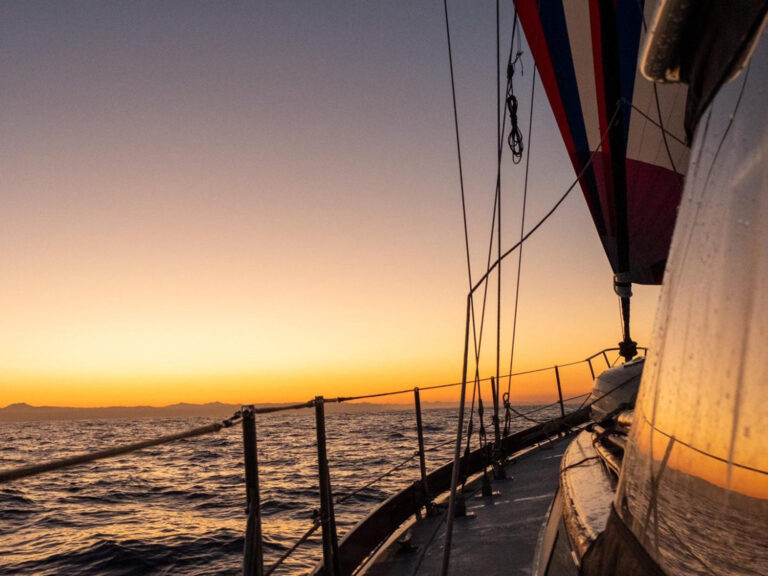
Salmon-orange light suffused the sky as we again anchored Catamount in the tiny nook where we’d started our journey 10 days earlier. The Pick Axe Blonde Ale came out of the fridge, and pasties went into the oven. Our circle was complete. We’d circumnavigated the peninsula, but more important, we’d gotten our arms around its soul. My sister was right: The Keweenaw is a special place.
When not exploring the wilds of Michigan’s Upper Peninsula and other Great Lakes destinations, Fred and Jennifer Bagley live in Mendon, Vermont.

