Micronesia 368
The South Pacific gets all the glory. Books, movies, and musicals all cast the journey south of the Equator as a romantic escape from the cacophony and complexity of the Northern Hemisphere. Even Crosby, Stills, and Nash got into the act when they sang-“When you see the Southern Cross for the first time, you understand now why you came this way.”
I went that way. I loved it, and I wouldn’t give back a minute or a mile of it. But the Pacific is a mighty ocean covering 64 million square miles. Its great waves pass unimpeded through political borders and topographical demarcations, and in its less-lauded waters north of the equator, it hides a gem called Micronesia. It seems incongruous to use “hide” when describing an archipelago of 2,100 islands stretching across more than 4.5 million square miles of ocean. But despite its expanse and its historic ties to the United States, to all but a few Americans, Micronesia remains terra incognita.
Mention “Tarawa” to an elderly World War II veteran, and you’ll evoke tales of terror and triumph spreading west from Pearl Harbor, one blood-soaked atoll at a time. Say “Palau” to a sport diver and she’ll wax poetic about the Crystal Chandelier Caves. But if you say “Yap” to the average man on the street, he’ll think you’re merely agreeing with him.
I once asked a friend where he was sailing to next. He said, “I have no plan, and I’m sticking to it.”
I liked that, but in truth, our Pacific Rim voyage has been carefully crafted to ensure that each landfall would be a personal first for both Diana and me. In spite of three decades of international cruising, this proved to be surprisingly easy. In fact, we faced a long list of enticing destinations that we’d yet to visit: Kiribati, the Marshall Islands, the Federated States of Micronesia, Guam, and the Northern Marianas. When we threw Japan, the Aleutians, and Alaska into the mix, we were forced to make some tough choices.
We shaped our route out of New Zealand to take in New Caledonia, Vanuatu, and the eastern Solomon Islands. This meant crossing the equator directly south of Kosrae, the easternmost atoll of the F.S.M. Kiribati and the Marshall Islands will have to wait for another day.
When the GPS blinked “Latitude 00.00,” we threw a line-crossing party. Alas, there were no Pollywogs for King Neptune to initiate, for this was my eighth crossing under sail and Diana’s fifth. On this crossing, we changed the meaning of the acronym I.T.C.Z. from Intertropical Convergence Zone to Incessantly Tough and Cold Zone. And so it was that after only eight days at sea, we were more than ready to taste land in Lele Harbor, on Kosrae’s east side. Those hardships were instantly put behind us when Cap’n Fatty Goodlander raced up in his dinghy bearing steaming sticky buns for Diana and ice-cold beer for me. I have written him into my will.
Kosrae is a mountainous island skirted by lowlands and mangrove swamps. A fringing reef creates an extensive saltwater lagoon lined with placid beaches. It’s the least visited of the four Micronesian states because it doesn’t have the famous wreck dives of Chuuk, the mysterious ruins of Pohnpei, or the colorful culture of Yap. However, it’s an attractive island with warm and welcoming people.
Particularly welcoming were the members of the Sigrah family, descendants of ancient kings of Kosrae who act as the official hosts of any arriving yacht because visiting cruisers had helped their father build the family home. To honor his memory and his fondness for welcoming sailors, they continue this tradition. We used their dock, dropped off our garbage with them, raided their freshwater tank, and attended a sumptuous feast that they threw for the five international boats present. Dinner included a roasted pig, traditional yam, tapioca, breadfruit, and coconut dishes.
Although the F.S.M. has been officially independent since 1986, the United States still pumps millions annually into its government. This trickles down in the form of government jobs and contracts that underpin a struggling economy. Ambitious plans for the development of tourism are thwarted by a lack of infrastructure and the rising cost of travel. But the economic and cultural aspirations of Kosraens are clear. They want to modernize. Traditional thatching has long been abandoned for corrugated tin roofs and unpainted cinderblock walls. Outboard engines push imported fiberglass boats. Baseball caps, and Oakland Raiders T-shirts have replaced indigenous garb.
We spent an active week refreshing the ship’s supplies, repairing the carnage of the passage, and hiking in the jungle. Emilson, our local guide, was a rare repository of historical, mythological, and botanical information. He uncovered sites of ancient battles, told tales of creation and sorcery, and drew sap from a tree for us to chew while climbing.
For me, the highlight was exploring the tunnel systems dug by the occupying Japanese army between World War I and World War II. I never felt closer to the harsh realities of war than I did in that twisting dank and darkness.
On our blustery passage from Kosrae to Pohnpei (or Ponape, as it’s also known), Diana asked me, “Just how hard is it blowing out there?” We don’t carry an anemometer on board, and I chose to underestimate a wee bit for the sake of morale. But just as I did, a VHF call from the nearby French-registered yacht NEOS informed us that the squall we were in was clocking winds at a steady 55 knots, with gusts to 62.
Diana cocked her head and aimed her eyes at me. “That’s only two knots short of an official hurricane!”
Busted! Still, for all its huff and puff, it didn’t blow our house down. Roger Henry, under triple-reefed main and staysail, made a snappy two-day passage to the F.S.M. capital of Kolonia, on Pohnpei.
“Capital” may be misleading, as Kolonia is a run-down town, struggling to maintain the simplest of modern infrastructure. This is ironic because few places on Earth can boast of such sophisticated ancient infrastructure. On the outer reef of eastern Pohnpei lie the ancient ruins of Nan Madol, majestic in its scale and mysterious in its origins. The canal streets and waterways linking the 93 man-made islands are often compared to Venice, but the physical accomplishment of transporting and assembling the tons of basalt pillars is best compared to the Egyptian pyramids. Although the area is believed to have been populated as early as 200 B.C., construction of Nan Madol began around the eighth century, under the authority of the Saudeleur kings. It grew and apparently thrived until it was inexplicably abandoned just before the arrival of the first Europeans in the 1500s.
Fellow cruisers Olivier and Pascaline of NEOS joined Diana and me for a tour of the complex. En route by ripping speedboat, we first stopped for a dive with the dancing manta rays in, naturally, Manta Pass. Once in the canals of Nan Madol, we switched to kayaks to better tour the 150-acre site. Our guide, Jos, explained the social, ceremonial, and religious significance of each structure. On the corner of one towering wall we saw a single basalt pillar that weighed in at 50 tons.
“How did they ever get stones like that out here to the islands and up there on that wall?” I asked.
Jos replied, “The archeologists believe the stones must have been transported by giant raft from quarry sites far away, then hoisted by an army of workers. But they haven’t found a single bit of evidence to support this.”
“And what do you believe?”
“We believe these stones were lifted into the air and flown here by hunani, priests with special powers. This power isn’t magic as you might call it, but more a form of enlightenment, a mental control of all matter.”
Whether mechanically or telekinetically transported, the important point here is that complex and accomplished cultures have existed in this region of the Pacific for far longer than is popularly recognized. A resurgence of Micronesian pride and cultural identity is due in no small part to the increasing international fascination with Nan Madol.
But Micronesian pride can extend beyond ancient man-made marvels to several gifts of nature. Pohnpei itself is a high, forested island with many scenic attractions, but the pearl of the province is the uninhabited Ant Atoll, which lies just 10 miles to the southwest.
Perhaps to ease my own conscience, I’ve often tried to convince my hard-working family that the cruising life isn’t as idle or idyllic as it may seem. But a single photograph of our holiday antics within that pristine atoll would discredit me forever. Four boats, from the United States, Australia, Denmark, and France, shared the anchorage. (See “Holiday Time at Ant Atoll,” Passage Notes, October 2009.) On Christmas Eve, festive carolers swam from boat to boat to sample the international cuisine. Christmas Day was spent sipping laced coconuts in the surf along a sweeping white beach, while fresh fish grilled on an open fire. At the stroke of New Year, we dove from the high decks of the classic powerboat Westward into the moonlit waters below. I had the thought that the instant comradeship and good will felt between cruisers of any age, race, religion, or national origin is the embodiment of the Christmas spirit without seasonal restraint.
After two sun-soaked weeks, Diana and I tore ourselves away from these pleasures. We faced a plethora of landfall choices in the states of Chuuk and Yap. In the end, we decided to focus on the atoll of Lamotrek, in eastern Yap, because it reportedly still possessed a vibrant traditional culture.
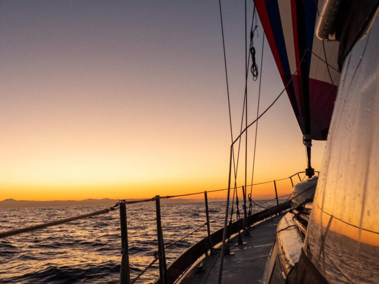
With the spinnaker breathing like a slumbering beast, we ghosted 700 miles to the west. We hove to for the night to windward of Lamotrek so we could reach through one of the narrow passes into the eight-mile-long lagoon at dawn. We dropped anchor just off the village into 50 feet of clear water.
After a week at sea, vibrant colors and earthy smells filled our senses. A world of wonder waited just behind those coconut trees. But once the anchor was snubbed, the sail cover secured, and the tiller tied, a deep fatigue set in. We longed to crawl into our berths and sleep until we couldn’t. But custom demanded that we row in and introduce ourselves.
A huge man dressed in a loincloth met us on the beach. Francis is a schoolteacher, speaks perfect English, and, although living a very traditional island life, has much experience with the outside world. He was the perfect translator and guide.
Francis led us to a towering thatched structure. Twenty men, dressed in scant loincloths, were adzing a breadfruit log into the rough shape of a canoe. We were offered a cup of the ubiquitous tuba, a heady coconut beer. I told Francis that I’d like first to meet the chief and ask his permission to anchor in the lagoon. Francis translated. The men nodded in approval, agreeing that this was the proper way.
He led me to an elderly man sitting on a log. I introduced myself to Chief Joseph and offered him a big plait of tobacco and a box of matches. This is an old custom-simple yet respectful-and, in our case, particularly timely. The supply ship had been broken down for months. The villagers were out of rice, flour, sugar, canned goods, and much-prized tobacco.
Besides matches, Chief Joseph found 10 shiny fish hooks in the box. Puzzled, he asked Francis for an explanation.
I said, “It seems an island man is always short of two important things-dry matches and a good sharp hook.”
He smiled, turned to Francis and said, “Tell them they are welcome here.”
Much like the Polynesians, hospitality and generosity are the cornerstones of the Micronesian culture. Francis laid lush floral wreaths on our heads, offered us woven baskets holding taro, fried breadfruit, and cups of raw clams, and sent an army of children off in search of the sweetest drinking coconuts.
The genders don’t mix in public except for church and festivals. The men have boats to build and fish traps to set. The women have cooking fires to tend, taro patches to weed, and lavalavas to weave. The segregation is strict, but the arrival of what they call a “yachtboat” is a big event; excitement erodes discipline. Scores of bare-breasted girls and women hung back among the coconut trees, their eyes riveted on Diana.
The moment that Diana wandered from the boathouse, she was spirited away by the women. Her normal shyness was completely overcome by her fascination with the fine traditional weaving. She disappeared into the smoky huts, discussing back-strap looms, warp and weft tensions, dyes, native materials, and traditional patterns and their meanings. The lavalava is the female costume de rigueur and still a form of currency. Despite the enormous efforts required to weave one, Diana was given two as gifts. In return, we brought much needed medicines, rice, sugar, flour, and oil to shore the next day.
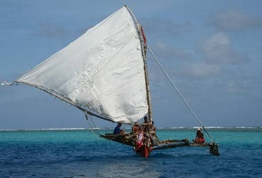
Like the neighboring island of Satawal, Lamotrek has an ancient seafaring tradition. Historical records indicate that for at least the last 500 years, sailors from Satawal and Lamotrek have regularly ventured as far as Guam and the Northern Marianas. My days were completely devoted to learning everything I could about the construction, maintenance, sailing, and navigation of their traditional proas. These oceangoing crafts are measured by how many giant turtles they can safely carry; a 13-turtle canoe establishes the upper end. I watched as men lashed hand-hued planks to a dugout hull with coconut sennet, then caulked the seams with breadfruit tree gum.
The village is divided up into five boathouses. These physical structures also confer social organization on the community. A young man might attach himself to a particular boathouse because he has a favorite uncle there or many friends. Even if he’s too young to join the members in their tuba-drinking rituals, he will begin his education in canoe building, rope making, fish-trap weaving, and sailing; if he’s particularly gifted, he might enter the secret society of star-path navigators. There’s no conflict or competition between boathouses. In fact, one house may lend a team of laborers to another for a particularly big boatbuilding project. The important point is that sailboats are the physical, psychological, and even spiritual epicenter of their lives. I can relate.
Among the sailors, of course, there are virtuosos. Stanley is famous throughout Yap for building especially fast proas. He’s now too old to tackle such ambitious projects, but many boat owners will sail their canoe to Lamotrek from outlying islands just to have Stanley “tune it up.”
Stanley has his boys sail the proa back and forth in front of him. He studies the boat for several days. Then he directs a craftsman to adze away a quarter of an inch here, move the mast step an inch forward there, or place a rock in the bow to alter the trim. I sailed on a newly Stanley-tuned boat and the proud owner just smiled as we ripped across the waves.
I donated sail needles, thread, and hardware to one boathouse, and I demonstrated western stitching techniques to their sailmaker. For another boathouse I fixed a pile of broken spearguns and took the men out for a day of spearfishing on board Roger Henry. I made a point of dropping by to see Chief Joseph every few days to present a little gift of tobacco.
To repay Francis for his overwhelming hospitality, I took his group out for a day of very successful trolling in the turbulent waters to windward of the atoll. We feasted under the stars that night on thick slabs of raw wahoo and mahimahi dipped in coconut cream. Our days were so full that Diana and I only got to meet at night-that is, on the nights that the men would release me from my tuba-drinking duties. And duties they were, for every man is expected to participate in these bonding ceremonies. From 3 p.m. to 5 p.m., the men sip tuba while still working on their canoes. At 5 p.m., they go off to notch new coconut branches that drip sap into suspended containers. This fluid then begins to ferment into tomorrow’s supply of tuba. At 6 p.m., every man in the village returns to his boathouse and spends until the curfew at 9 p.m. in a drinking circle with his mates. A single cup is passed from man to man. There’s no sipping. It’s down the hatch, and the cup passes to the next man. They are big men, and they sport bellies of which a Bavarian would be proud.
On Sundays, we sat on the floor of the crowded church and listened to joyous harmonies. After services, we shook nearly every hand in the village of 400 people. We were invited to eat in so many homes that we staggered back to our dinghy. Where Ant Atoll had offered us weeks of splendid isolation, Lamotrek provided weeks of total cultural immersion. It was exhilarating and exhausting.
We grew quite close to Francis and Bibiana, his wife, and their three gorgeous children. Bibiana begged Diana not to leave. But Francis is a sailor, and when the fortified trade winds veered to the east, he agreed that it was the right weather window for fetching Guam. That is, after one last party.
When it was finally time to go, we set the mainsail, raised the anchor, and started to pull for the outer pass. I looked back to the beach to see several dozen people blowing their conch horns, singing, and wildly waving goodbye. I was deeply touched, and I was sad to see these kind people, struggling for their physical and cultural survival, fade beneath the horizon.
I’ve spent my life traveling. I’ve learned that I should never compare one people or place to another, for they simply are what they are. However, I’d be hard pressed to name another cruising destination that offered more miles of pristine beauty, more unfamiliar cultures, and more open-hearted hospitality than this seldom-visited outpost of the North Pacific.
Therefore, I’d like to propose a new acronym: Henceforth, let “F.S.M.” stand for the Fabulous States of Micronesia.
Alvah and Diana Simon continue to cruise in the North Pacific. But they’ve traded in the sunblock for sweaters and seaboots as they explore the colder coastlines of Alaska and the Pacific Northwest. Keep track of their progress via Alvah’s blog, The Roger Henry Files, at CW’s website (www.cruisingworld.com).
The F.S.M. at a Glance
The Federated States of Micronesia is the largest entity to be carved out of the old United Nation’s Trust Territory of the Pacific Islands. The nation, part of Micronesia, is divided into four states: Kosrae, Pohnpei, Chuuk, and Yap.
Geography: A total land area of a scant 270 square miles, of which Pohnpei accounts for half, stretches east to west for over 1,700 miles. Kosrae, Pohnpei, and Chuuk are considered to be in the Eastern Caroline Islands; Yap is in the western Caroline Islands. Kosrae and Pohnpei islands are large, mountainous, and forested. Most other islands are on raised or emerging atolls, which are small, low-lying, and only marginally fertile.
Population: The nation’s 105,000 people inhabit only 65 of 607 islands. Approximately 85 percent live in Pohnpei, at Chuuk Lagoon, and on Yap island. The vast majority are Micronesian. A small number of Japanese, Chinese, and American business people complete the community.
Language: There are eight indigenous languages. Japanese, Chinese, English and 18 other languages are spoken.
Currency: The U.S. dollar is the nation’s currency.
Cost of living: The cost of living is moderate to expensive.
Ports of entry: The F.S.M. ports of entry are Lele Harbor, at Kosrae; Kolonia, on Pohnpei; Weno Island, at Chuuk Lagoon; Colonia, on Yap island; and Ulithi Atoll, in Yap. Stops on outlying islands prior to initial entry are prohibited. Complete clearance procedures are required for each of the F.S.M.’s four states.
Visas: Visas are not required for U.S. citizens and a 30-day visa will be issued when you arrive if you do need one.
Permits: Apply for a cruising permit in advance. Contact the Chief of Immigration via mail (P.O. Box PS105, Palikir, Pohnpei, F.S.M. 96941) or telephone (691) 320-2605; fax: (691) 320-7250). This office will fax you an application.
Climate: Temperatures average 80 F year round. January through March is the almost-dry season. The rest of the year is wet by any standard. Pohnpei records rain on 300 days a year.
Winds: The northeast trade winds prevail from October through May. The southwest monsoons occur from June thought September. Strong southwest gales are possible in August and September. Typhoons have been recorded in every month of the year. However, the period from December 1 through April 30 is considered relatively safe. The western Caroline Islands hold the world record with an average of 19 typhoons per year!
Supplies: Food, fuel, and propane are available at Kosrae, Pohnpei, Chuuk, and Yap. Be sure to carry plenty of cash; Kosrae, for example, has no ATM, and the bank there has no mechanism whatsoever by which you can obtain cash.
Resources: Moon Handbooks Micronesia by Neil Levy (6th ed., $18; www.southpacific.org/micro.html), a comprehensive travel guide packed with essential information for the sailor and backpacker alike, offers particularly good history and culture sections. Landfalls of Paradise by Earl Hinz and Jim Howard (5th ed., $50; www.landfallnavigation.com) is ambitious in scope: It covers the entire Pacific, and the information specific to cruising in the F.S.M. is accurate and helpful. Noonsite is a website (www.noonsite.com) that offers cruiser-specific background information and current details relating to entry, health issues, customs, quarantine, and the like. The F.S.M. Visitors Bureau official site (www.visit-micronesia.com) offers travel, accommodation, and event information on a state-by-state basis. A.S.

