Quicklook: State-of-the-Art Boating Safety Equipment
- Emergency Position Indicating Radio Beacons (EPIRBs)
- Personal Locator Beacons (PLBs)
- Automatic Identification System Man Overboard Devices (AIS MOBs)
- Bluetooth MOBs
- Two-Way Communicators
Evolving Marine Safety Technologies
I still remember waving goodbye to my mom, as my dad, three of his buddies and I pulled away from the dock in Bar Harbor, Maine. We were bound for the Gulf of Maine and, eventually, our home port on Long Island Sound. The year was 1987; I was 10, and I had begged to go offshore. Consequently, I had made my share of promises so that I might find myself—a mere boy—on a bona fide delivery. Among them were a promise not to venture forward of the cockpit and to wear an (awful) orange Type II life jacket with a homemade chest harness and safety tether.
While my dad’s old C&C 37 got us through in fine form, I quickly learned that I hate being seasick even more than I despise Type II life jackets.
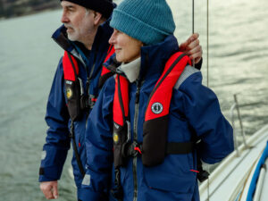
Fast-forward 35 years to my most recent offshore adventure: a delivery from Ketchikan, Alaska, to Seattle via the outside of Vancouver Island, aboard a lickety-split Riptide 44. Many things had changed. For starters, there was no seasickness, nor was there any time spent languishing at 5 knots. There also was no awful orange life jacket. Instead, I wore my brand-new PFD, which contained an AIS MOB beacon set up to trigger automatically if the PFD inflated. I also carried a PLB.
While there’s no comparing the boat speeds or water temperatures involved in these two adventures, there’s also no comparing the safety gear. Sure, hypothermia would arrive much faster in British Columbian waters than in the Gulf of Maine in August, however, my AIS MOB beacon would guide my own vessel back to my real-time position, while my GPS-enabled 406 MHz PLB would alert the correct rescuing authority.
Satellite-Based Innovation
When it comes to safety at sea, modern mariners have two important pieces of satellite-based defense available: EPIRBs and PLBs. Both are underpinned by Cospas-Sarsat, which was founded decades ago by Canada, France, the United States and the former Soviet Union to provide a free emergency-signal relay service for mariners of all flags.
Today, Cospas-Sarsat involves these founders plus 43 other nations (and two agencies) that share the goal of providing, maintaining and innovating a global distress-signal monitoring system that directs the correct rescuing authority to an unfurling emergency as quickly as possible. To date, Cospas-Sarsat has saved more than 50,000 lives.
On the infrastructure side, Cospas-Sarsat uses transponders fixed onto search-and-rescue satellites (SARSAT) that operate on three constellation bands: geostationary (GEOSAR), low-earth orbit (LEOSAR) and medium-earth orbit (MEOSAR). As of this writing, there are nine active GEOSAR satellites and five LEOSAR satellites; once the network is complete, there will be at least 75 MEOSAR satellites aloft.
These satellites are supported by a global network of ground-based assets, including Local Users Terminals (LUTs), Mission Control Centers (MCCs) and local rescue coordination centers.
Satellite transponders spend the majority of their time monitoring for 406 MHz emergency signals, which originate from a vessel-registered EPIRB or an individually registered PLB. Once a satellite receives a distress signal, it either forwards the signal’s exact frequency and time it was received to a nearby LUT, or it stores and forwards the message to the next available LUT. Then, the LUT passes the message to an MCC in the country where the beacon is registered. The MCC, in turn, hands it off to the correct rescue-coordination center, which executes the rescue. In US waters, this last responsibility falls to the men and women in the US Coast Guard.
Modern EPIRBs and most PLBs are GPS/GNSS-enabled, meaning they encode and transmit their GPS or GNSS location information along with their unique 406 MHz distress signal. This is critical because accurate position information almost always reduces the amount of time it takes for Cospas-Sarsat to determine an active beacon’s position.
Triangulation
LEOSAR ground segments can determine a beacon’s location using Doppler processing, however, this requires at least three beacon bursts to determine the beacon’s correct latitude and longitude. MEOSAR satellites can perform almost-instant “trilateration” of an active beacon using what NOAA describes as 3D triangulation.
GEOSAR satellites, on the other hand, because of their geostationary nature, pass collected 406 MHz signals to LEOSARs and LEOLUTs for geolocation work.
In addition to their ability to execute trilateration—sometimes with only one beacon burst—the still-evolving MEOSAR satellite network offers other important advantages compared with the older GEOSAR and LEOSAR satellites. These advantages include sheer numbers (read: far shorter wait times than LEOSARs, which complete each orbit every 100 or so minutes) and the fact that multiple MEOSAR satellites are always looking at the same swatch of earth and ocean. This includes the high latitudes.
According to an example cited on NOAA’s webpage, on May 4, 2016, an EPIRB activated some 700 nautical miles west of the Galapagos Islands. The LEOSAR and GEOSAR constellations required 59 minutes to locate the beacon, and an additional hour and 18 minutes to confirm the signal; MEOSAR located the signal immediately, and confirmed it in 20 minutes. MEOSAR was about seven times faster, shortening the time by almost two hours. And in any emergency situation, time matters.
Keep reading to learn how and why technologies like these are quickly becoming essential tools in any modern boat safety kit.
EPIRBs
As mentioned, EPIRBs are registered to a vessel, not to individual sailors. They come with manually or hydrostatically released mounting brackets, and the EPIRBs themselves can be manually or hydrostatically activated. EPIRBs are physically larger than PLBs. Their batteries are required to enable signal transmission for at least 48 hours (some offer longer burn times), and they’re equipped with 360-degree strobe lights.
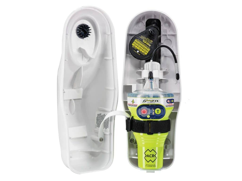
All EPIRBs sold in the United States on or after January 1, 2019, are required to be GPS/GNSS-enabled. One important and recent regulatory change came on July 1, 2022, when the International Maritime Organization began mandating that large commercial ships (read: SOLAS-level vessels) fit EPIRBs that are both GPS- and AIS-enabled.
While SARSATs listen for 406 MHz signals, AIS signals are transmitted via VHF radio and are received by every AIS-equipped vessel that is within VHF range. This makes AIS the preferred signal for so-called final-mile search-and-rescue work, and means that modern EPIRBs transmit four signals: 406 MHz, 121.5 MHz (an older-generation homing signal for final-mile operations), AIS and GPS/GNSS. As of this writing, the only EPIRBs that satisfy this requirement are ACR Electronics’s GlobalFix V5 EPIRB, Ocean Signal’s EPIRB3, McMurdo’s Smartfind G8 AIS and Kannad’s SafePro AIS (ACR and Ocean Signal are owned by the same parent company, while McMurdo and Kannad share similar lineage). Other manufacturers are expected to bring next-generation EPIRBs to market soon.
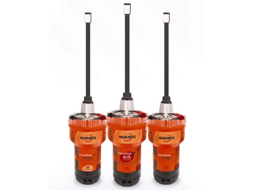
If you cruise with an older, non-AIS- and GPS/GNSS-enabled EPIRB, or with one that’s incompatible with the new MEOSAR satellites, this winter could be a great time to ask Santa for a boat safety kit upgrade.
PLBs
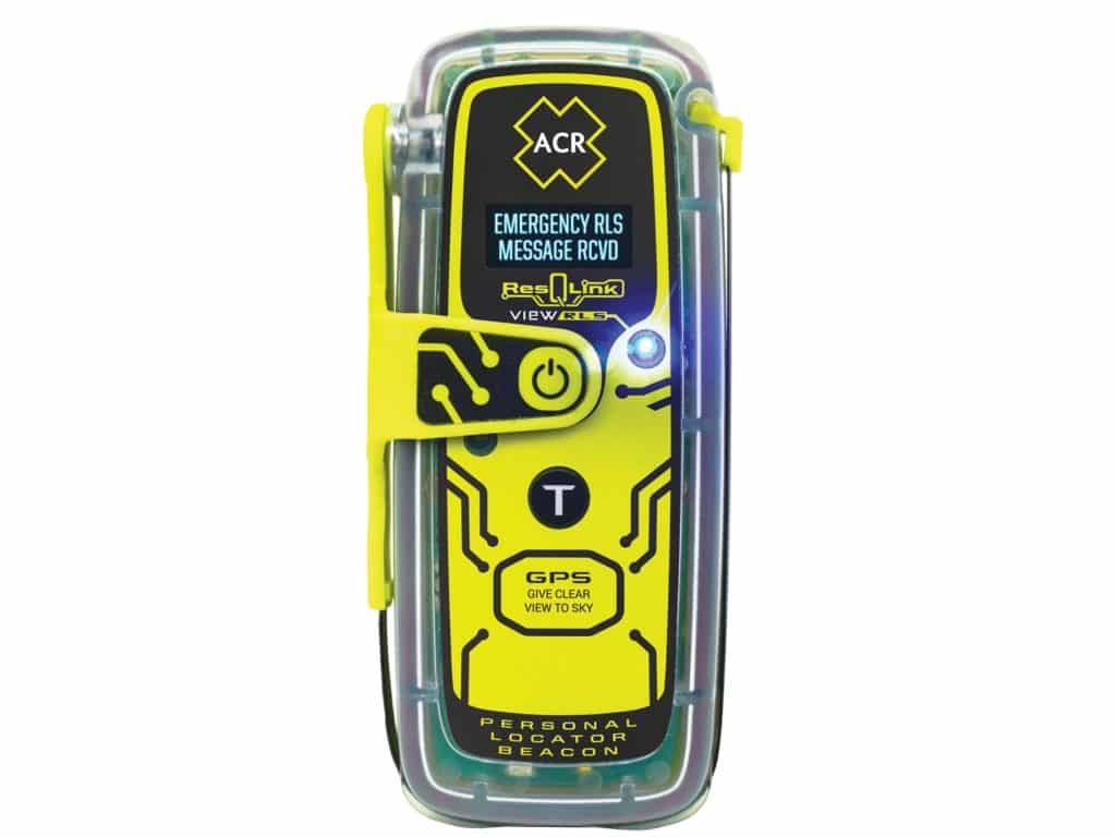
Personal locator beacons are designed to contact Cospas-Sarsat and are among the most important beacons that every sailor should carry. PLBs are typically pocket-size, are inherently buoyant or employ a buoyant case, and are manually activated. As mentioned, PLBs are registered to an individual, not to a vessel. Users must register their beacon after purchase; in the United States, this is done through NOAA’s website. Users can update their beacon’s profile as necessary.
This latter point is key. Before leaving for my recent delivery from Ketchikan to Seattle, I updated my NOAA beacon profile to describe our proposed sailing dates, expected routing, the vessel’s name, the (correctly spelled) names of each crewmember, the name of the vessel’s owner (he wasn’t aboard), some emergency contacts, and a description of the yacht (44 feet, white topsides, royal-blue undercarriage). All of this information would save critical time in an emergency.
Once sailing, I carried my PLB in a dedicated pouch attached to my PFD’s harness, and I secured a lanyard from the PLB to the PFD’s harness so that the beacon couldn’t float away if I found myself swimming (my AIS MOB was also backed up with a lanyard).
As mentioned, most modern PLBs—including mine—incorporate GPS/GNSS information with their distress signals, which can save a lot of time. Another important advancement involves relaying confirmation to the PLB that Cospas-Sarsat has received its distress signal. Tragically, there have been documented examples of mariners making fatal decisions because they believed their signals went unheard. As a result, some newer PLBs have Return Link Service (RLS), which means that once Cospas-Sarsat has received a distress signal, it initiates a reciprocal signal for confirmation.
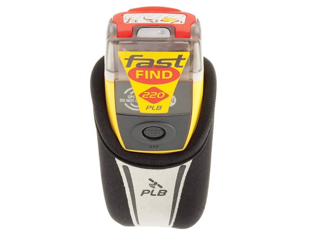
Anyone in the market for a PLB should spend a little bit more (ballpark $100 extra) and invest in a MEOSAR-compatible PLB that includes RLS capabilities.
While cruisers can expect to pay a few hundred dollars for a PLB, there are no subscription costs or revolving fees. PLB batteries are good for roughly five years of standby service and at least 24 hours of operation (manufacturers advise mariners to replace their batteries after use). Five years is also a good time frame for evaluating newer boat safety kit technologies and possibly upgrading beacons as new capabilities come online.
AIS MOBs
Having sailed and raced extensively in the Pacific Northwest’s cold waters, I’m well aware that one’s own vessel—or a nearby vessel—is the fastest way out of a MOB situation. As their moniker implies, AIS MOBs are individually carried but unregistered beacons that, when activated, transmit emergency signals over AIS. These signals trigger AIS alarms on all nearby vessels; these alarms include AIS MOB icons that appear on networked chart plotters and give real-time information about a MOB’s location.
AIS MOBs include an AIS transmitter, integrated GPS (or GNSS), usually a Digital Selective Calling (DSC) transmitter, sometimes an integrated strobe light, a battery and an antenna. Once activated, AIS MOBs transmit position information that’s accurate to within a few meters for at least 24 hours.
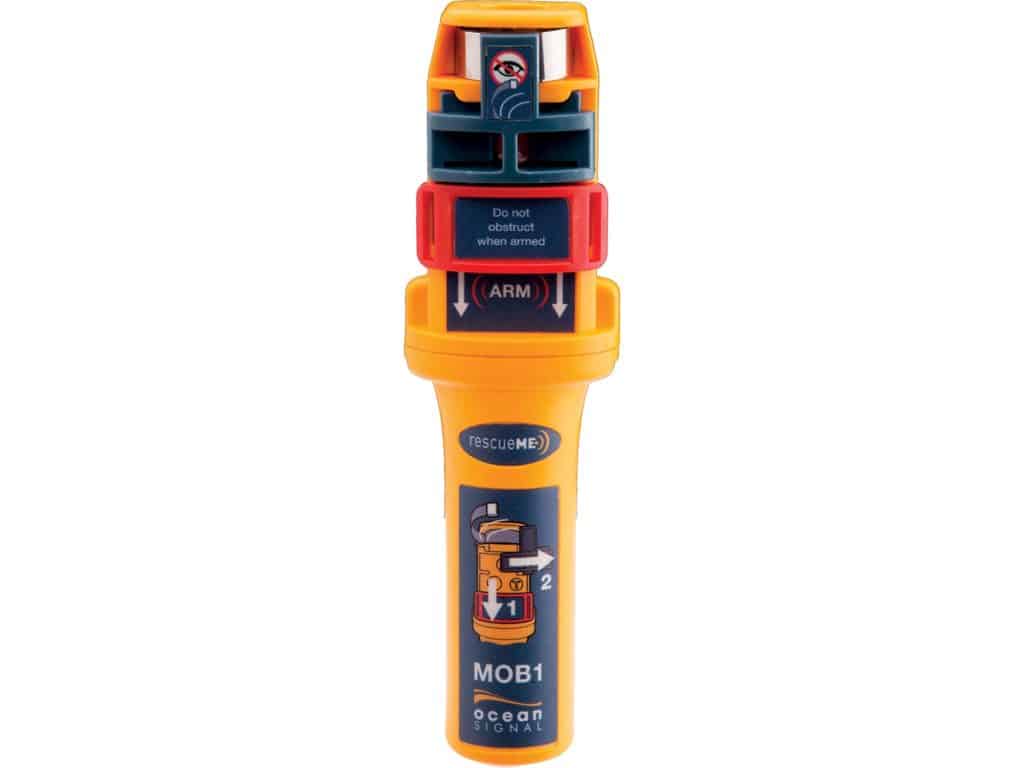
While most AIS MOBs are manually activated, some—including Ocean Signal’s MOB1 and ACR’s AISLink MOB (owned by the same parent company)—can be rigged inside a personal flotation device so that when the PFD inflates, it pulls the pin on the AIS MOB. This way, the AIS MOB starts broadcasting within seconds. This feature is especially important if the MOB is injured or goes into shock.
Bluetooth Devices
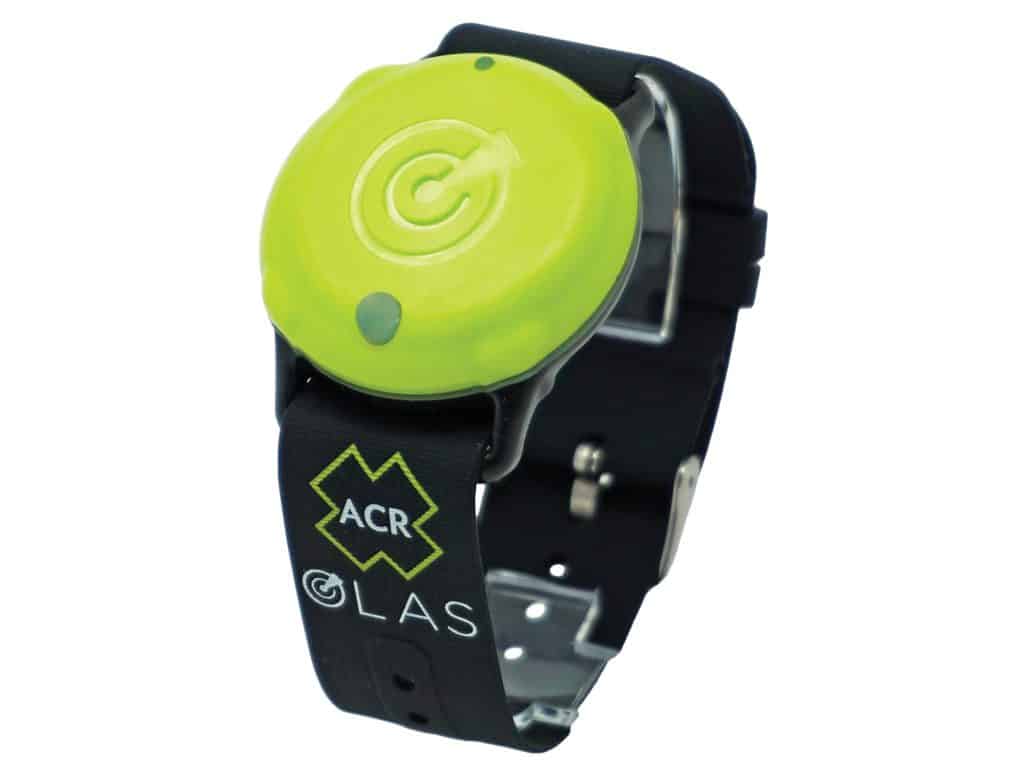
In addition to PLBs and AIS MOBs, companies including ACR also make Bluetooth-based MOB alarms. These consist of an onboard base station that typically pairs with a wireless device running a dedicated app, plus a series of crew-carried pendants or tags. Should a tag break its geofence, an alarm is tripped on the app, which captures the tag’s current GPS location. Users can navigate back to this last-known MOB position; however, it’s important to understand that set-and-drift means an MOB can travel some distance from where they fell overboard.
Also, unlike AIS MOBs, whose emergency signals and real-time positions are displayed by all nearby AIS-equipped traffic, Bluetooth screams can be heard only by the tag’s paired base station. So, while Bluetooth-based MOB devices are affordable, and sometimes even include an engine kill switch, they don’t afford the same protection as an AIS MOB or PLB.
Two-Way Communicators
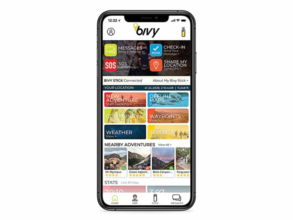
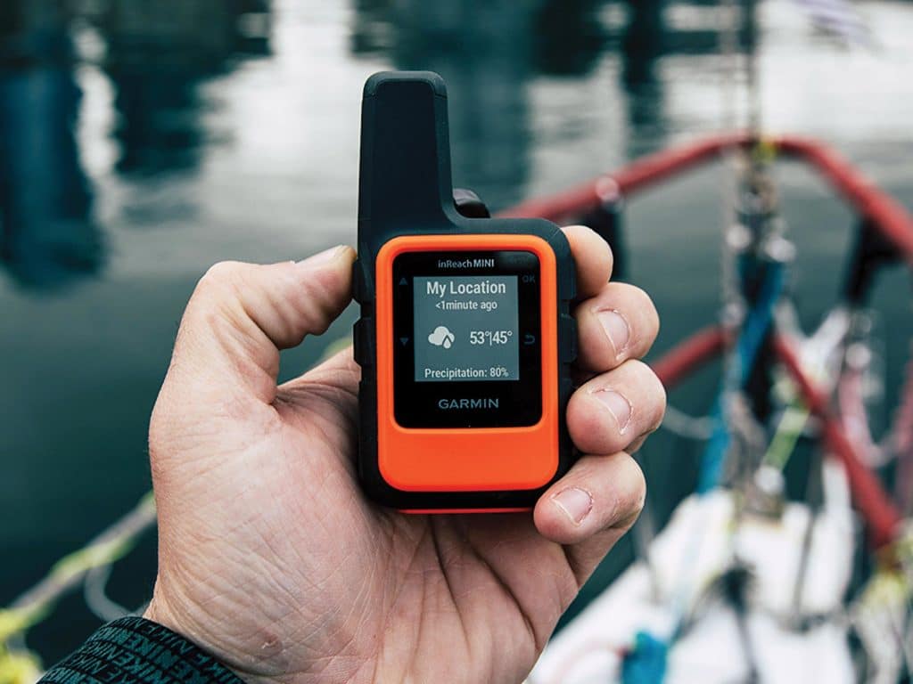
Recent years have seen the advent of satellite trackers that offer two-way satellite communications and the ability to contact a privately operated emergency-response center such as the (Garmin-owned) International Emergency Response Coordination Center (IERCC). That center, in turn, contacts the correct rescuing authority.
These two-way communicators are GPS-enabled, which means they can share your exact location information. They also have two-way communications (typically using a third-party wireless device, but sometimes on the communicator itself) that can be crucial in an emergency. Product names include Garmin’s inReach, Spot X and ACR’s Bivy Stick. The devices can sometimes be used for navigation and to get basic weather information, but they do require a subscription plan (although typically not for issuing an emergency signal).
Gold Standard Technologies for Your Boat Safety Kit
Given the available technologies, the best electronic boat safety kit tools for ensuring safety at sea are a contemporary and properly registered EPIRB, a properly registered and updated PLB, and an AIS MOB. This setup is the safest way to sail. As for cost, remember: No one ever wished they owned a cheaper parachute before pulling the rip cord.
David Schmidt is CW’s electronics editor.
Stop the Press!
ACR Electronics and Ocean Signal (same parent company) announced the first combination 406 MHz and AIS-enabled boat safety kit beacons: the ResQLink AIS PLB and the PLB3 (respectively). These devices are registered to an individual, and can be considered the gold standard for all-in-one beacons. If you’re looking to upgrade, these game-changers could be just the ticket.
Vendor Information
ACR Electronics; from $310
Garmin; from $350
Kannad; call for pricing
Netwave; call for pricing
McMurdo; from $290
Ocean Signal; from $310

