Are you planning to sail to the Caribbean this fall? Are you excited about spending a few weeks bareboating in the islands this winter?
Dreaming about which island to visit next can lead to some serious reading. Here are a few suggestions about resources that will let you feed those dreams with hearty, nutritional content instead of junk.
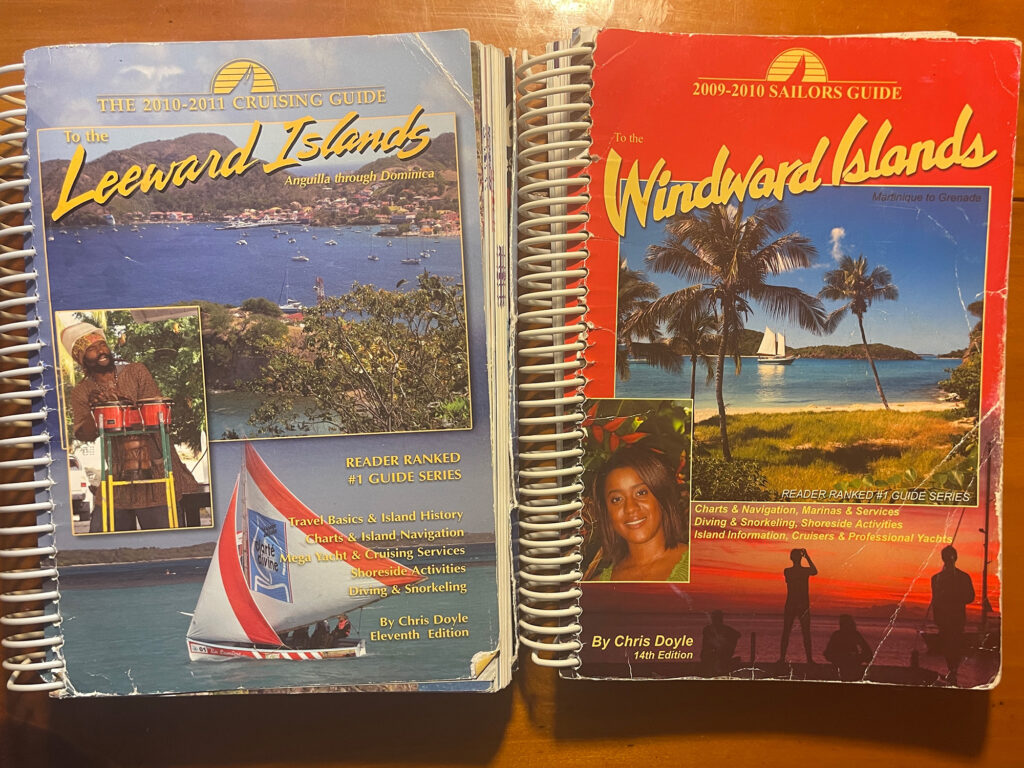
There are stacks of references to check before hoisting the sails and anchor. I unfold Imray charts, check the chartplotter for distance, log onto Facebook groups—there’s one for every island—and download the weather forecast. Then, I see what’s up with the ActiveCaptain app. I flip pages in the Doyle Guides to the Leeward and Windward Islands, or in the Cruising Guide to the Virgin Islands by Nancy and Simon Scott. There are others, including a dozen guidebooks compiled by Don Street.
Today’s boaters don’t know how lucky they are to have all these resources. It hasn’t always been this way.
One of the first books I read about sailing in this region was Isles of the Caribbees by Carlton Mitchell, published in 1966. Mitchell takes us aboard the yacht Finisterre from island to island through the Eastern Caribbean, with images by National Geographic photographers. I could see what those islands looked like. This book sent me off dreaming of sailing to the tropics.
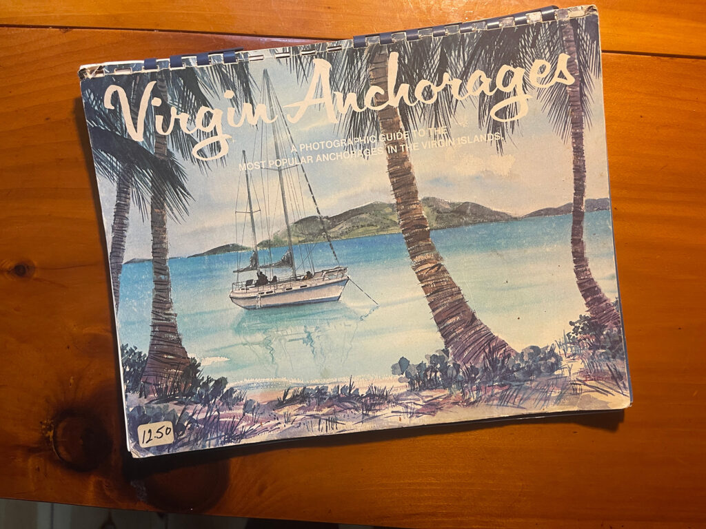
In 1978, I finally got to the Caribbean for the first time, on a Morgan Out Island bareboat charter out of Red Hook on St. Thomas in the US Virgin Islands. While I’d grown up on lake boats and spent 10 years cruising the New England coast aboard Quinta, my 36-foot Alden sloop, I had no idea what I’d find in the tropics. The charter company gave us a spiral-bound guide, first published by The Moorings in 1974, with aerial photos of anchorages. It included a few words about anchoring, but no information about what we might find ashore. This was to be a DIY adventure.
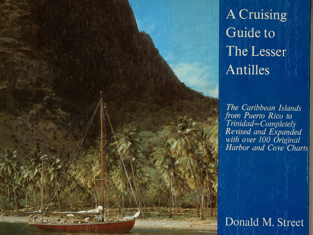
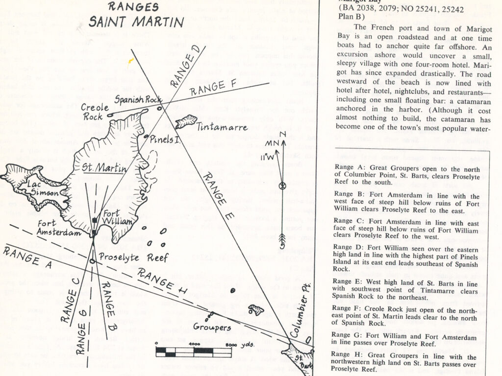
When I decided to sail my second boat, Fair-Thee-Well, to the Caribbean in 1981, I needed to do some serious research. Street’s books caught my attention. I still have them. It was Street’s A Cruising Guide to the Lesser Antilles, published in 1964, that paved the way.
He not only provided advice on the various routes from anywhere north to the Caribbean, but he also provided detailed information about every cove, harbor and anchorage on every island. His writing was highly opinionated, and for good reason. He had sailed the Antilles for 50 years.
Street wrote for the serious voyager—the boat owner—not the bareboater. He was less interested in beach bars and French restaurants than in how to get into small coves and anchorages without hitting a reef. Reading Street is like sitting in the cockpit with a beer or a rum punch, listening to a crusty adventurer spin yarns and provide advice. His books are valuable and entertaining, a journey unto themselves. One of my favorites is Seawise, a collection of Street’s thoughts on every aspect of boat ownership and cruising.
His books haven’t been updated recently, but they are still valuable references. As he writes: “The bars and services ashore may change from season to season, but the rocks and reefs haven’t moved in a hundred years.”
Street’s website has a great deal of what he has written, too: street-iolaire.com/
Doyle Guides and App
Chris Doyle’s guides to the Leeward and Windward Islands have been around since the early 1980s. He’s an Englishman who sailed the Colin Archer ketch Sugar Creek across the Atlantic to Grenada in the late 1970s. He skippered charter boats and bareboats, made deliveries, and got to know the islands well. After being pestered by bareboaters asking for directions, he published his own guidebook, selling advertising to cover the cost of printing. He sold the book from boat to boat while paddling his Windsurfer around anchorages. He has been at it all these years.
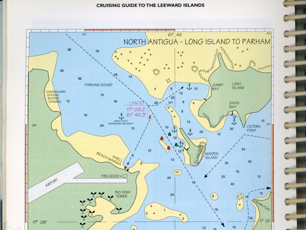
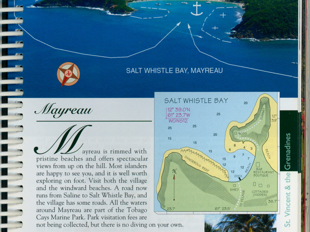
I’ve been using Doyle Guides for 40 years. I even find the ads useful because they put a face to the services ashore. Doyle Guides also include colored sketch charts as well as information on marine services, hiking trails, restaurants and markets. New editions are printed every two years.
The Doyle Guides app is free and has the newest information. A map shows your current GPS location, and the app lets you locate post offices, Wi-Fi, ATMs, immigration offices, marine stores, dive operators, markets and restaurants. If you get lost ashore, it’ll show you where you are. I even use it while researching from my home in Maine.
You can also download the guidebook to your device. Lexi Fisher, a Grenadian who handles the day-to-day Doyle Guides updates, told me: “The Doyle Guides app has all of the same general information as the printed guides. However, I can instantly update the app version whenever any changes occur. This I do about every two or three days, as information comes in.”
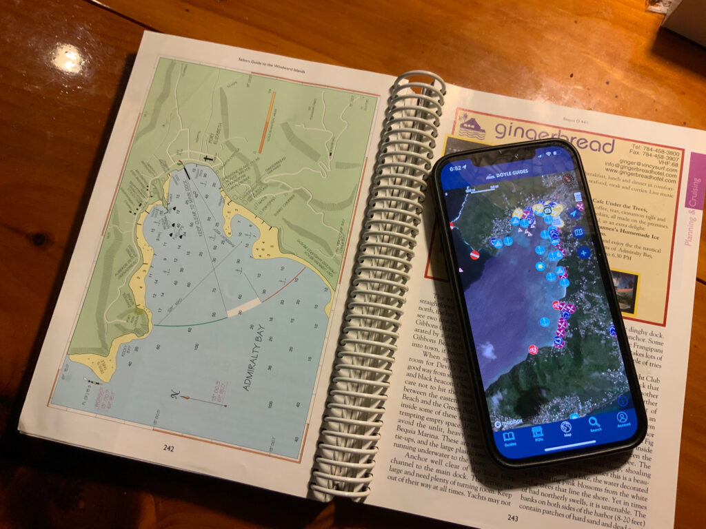
Charts show locations for shoreside attractions and services. Click on one, and up pops detailed information. The app will even place a phone call for you. It’ll show you where there’s fuel and a hospital.
I find that the printed guides are easier to use while I’m on deck, steering the boat, but I like the app too. It lets you access the content offline if you don’t have Wi-Fi.
And yes, I’m paging through my 2009 edition right now, planning next winter’s adventures.