ARGUS
As happens with many a good sea story in which the ship strays toward unchartered waters, the voyage of the ARGUS System is now headed in a direction that was perhaps unforeseen by those plotting its course at the outset.
ARGUS, which stands for Autonomous Remote Global Underwater Surveillance, is the brainchild of Survice Engineering, a Maryland
company that in August 2009 announced it was working with the National Oceanic and Atmospheric Administration to develop a survey platform to harvest position and depth data from chart plotters and depth sounders carried by ordinary vessels. NOAA was in search of a way to reduce the cost and time required to map the seafloor, and the idea was to ask mariners to do what they like to do best: go boating and, by doing so, collect information about both busy waterways as well as remote locations that NOAA survey vessels either can’t visit or visit so infrequently that the soundings in these areas may be suspect.
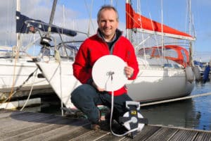
Using an off-the-shelf C.P.U. and a WiFi antenna, Survice built a dozen sampling devices costing less than $1,000 apiece. They record information while a vessel is under way and store it so it can be downloaded automatically when the captain finds a WiFi hotspot and stops to check email or go online. The ability to access the Internet, in fact, is a little bonus to the participants.
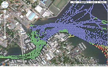
The system, says Survice’s John Hersey, went live this past July, and in just five months collected some 1.86 million data points, primarily in Chesapeake Bay, Barnegat Bay, and along the Intracoastal Waterway. Users so far have included a handful of Sea Tow captains and recreational skippers.
The bad news: After an initial assessment, NOAA determined that the soundings don’t meet the most stringent standards it requires for charting, so the agency is no longer backing the project. The good news: The data’s pretty darned good, regardless. The company believes there’s a market out there for up-to-date soundings that can be easily collected and overlaid on existing electronic charts, and it’s currently working with EarthNC of Florida to find ways to share this information with boaters, such as those who thread their way through shifting shoals along the Mid-Atlantic coast. Visit argus.survice.com/betatesting.html to see sample overlays.
In the meantime, says Hersey, the company’s looking for other ways to commercialize the data and thereby fund its collection. ARGUS, for example, has caught the attention of the U.S. Army Corps of Engineers because it gives a snapshot of areas along busy shipping lanes that may need dredging. As of year’s end, Hersey said the company is still looking for volunteers headed to warmer U.S. East Coast destinations to mount beta units on their boats. And ideally, the company will find new funding and build several dozen more systems that can be put to work. With luck, the voyage of ARGUS will prove to be a good one for both mariners and the company. That would be a sea story with a happy ending.

