After rounding southeast Newfoundland we could finally head north. It’s pretty incredible how far east you have to go before you can turn north heading from the U.S. east coast. Canada is wider than it looks on a map. It was great to finally be heading north towards Greenland but now we had our first real obstacle, southern icebergs.
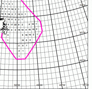
Icebergs comes out of Hudson Bay and the Labrador Sea and travel south to southeast. It was one of these southern icebergs that sank the titanic, so you know they can be pretty serious. Basically you look at an ice map which is a map broken into squares with numbers estimating the number of bergs in that region. You try to steer a course connecting the boxes that have the least amount of icebergs (check picture). At least that is the theory. The wind direction ultimately determines which box on the map you have sailed into and you just do your best to keep a sharp lookout. A sharp lookout in the fog that is. It’s a good thing we installed a radar before we left.
Sailing in the fog day after day is strange experience. It can even be a bit claustrophobic. It can be blowing a gale and still be incredibly foggy, and rainy. Hard to imagine a more dreary place to sail than the southern Labrador Sea. The grey foggy sky gives the water a greyish color so you’re completely surrounded by grey, for days on end. The fog can come or go so quickly that it seems like someone flipped a switch and the pea soup fog machine turns on or off. Fog itself is nearly always misting water so the deck, lines, everything outside is always wet. Mixing icebergs into this equation makes for sleepless nights. My stomach is not happy with all the coffee I’ve been drinking lately.
We are now north of the Southern ice belt, it will be a little while before we get far enough north to see the big boys. Huge icebergs that can be a mile around, hundreds of feet tall and who knows how deep. These southern bergs are hardly an appetizer compared to the feast waiting in the Arctic. Each iceberg is a unique and always changing natural sculpture. Icebergs are one of the most beautiful natural phenomena’s I’ve ever seen.
Last time I sailed north along this route in 2011 I had 20-25kt southerlies for days pushing me north. I think I was making slightly better time in the Albin Vega then we are in this boat. It’s basically the same conditions I experienced before. I had one gale on my way to the Arctic Circle last time and it looks like we will have a gale hit us tonight or tomorrow. Not a big deal, that’s what third reef points are for. We may get another gale later in the week, but as long as the wind is from the south we make good time. Once we get to Greenland we can hide from gales in the various fjords, at least you can in central West Greenland. Its gets harder to find protection in Northwest Greenland. At any rate it will be a nice change of pace from this grey ocean sailing we are doing right now.
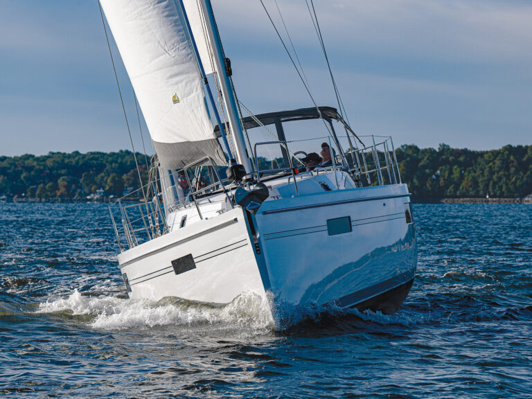
I am currently writing this blog while sitting in the pilot house watching the seas roll up from behind us, break slightly and pass by giving us a push. The winds are blowing 25kts and building, rain is coming and going in sheets and the fog is growing thicker. The gale is coming. It’s this type of weather that makes you love a pilot house. I’m relatively warm, dry and out of the elements. This would be miserable if we had to sit out in a normal cockpit, cold, wet with nothing to do but stare into the fog. At least that was what it was like last time I sailed the Labrador Sea.
Vincinimus Fortitudine
–Matt Rutherford

