Growing up, I always looked forward to our annual Down East cruises along the Maine coast, but I was never a fan of loading provisions and other assorted gear aboard. At the wise age of 10, it seemed to me that my dad, an engineer, physicist and expert navigator, took what I considered to be dawdling steps when it came to stowing canned goods, tools and spares aboard Windancer, the family’s C&C 37. After all, unloading groceries and suitcases at home was a quick and easy job, so why should it be any different aboard a boat?
Flash forward 30-plus years and many thousands of miles on the wheel, and I’ve gained appreciation for my dad’s meticulous preparations, especially considering some of the self-inflicted headaches that I’ve witnessed on boats when skippers have been less concerned with where ferrous metals (read: iron and iron alloys) were stowed, triggering cascading compass and heading-sensor problems.
In theory, driving a sailboat in a straight line is simple enough. Just hold the helm steady, right? But as anyone who has sailed on waters larger than a millpond knows, numerous factors can influence one’s heading — say, set, drift and wind — and even skilled helmsmen struggle to maintain less than 5 degrees of heading inaccuracy over helm sessions longer than 15 minutes.
Moreover, once offshore and away from fixed visual references, driving becomes a matter of trusting one’s steering inputs. Most modern boats typically carry a range of equipment capable of providing accurate heading information. However, troubles arise when onboard compasses and heading sensors start quarreling or acting catawampus. Here’s a look at different types of heading inputs, how to troubleshoot conflicting metrics and how to determine the best source of information in a sea of alternative facts.

Get Your Bearings
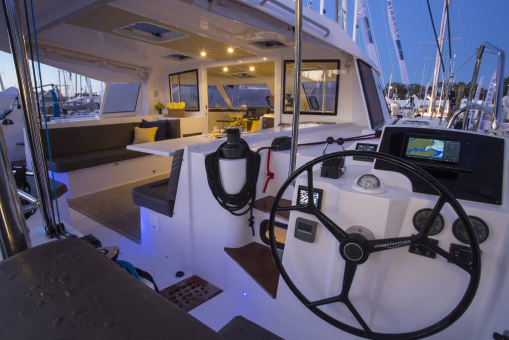
Trusty magnetic compasses were developed in China during the Han dynasty (206 B.C. to A.D. 220), followed some 2,000 years later by liquid-filled, or “wet,” compasses that use oil or liquid to dampen the motion of moving parts. Like their forebears, wet compasses point toward Earth’s magnetic north pole (not the true north pole, which is some 1,000 miles away). Modern binnacle, or ball-style, compasses are fixed-mounted and house a gimbaled compass card that sits atop a fixed pivot and rotates to always point north. Users determine their heading by lining up the compass’s lubber line, which corresponds to the boat’s centerline, with the closest mark on the card, which reads from zero to 359 degrees.
While magnetic compasses are reliable, they need to be adjusted for two factors. Magnetic declination, known as variation, refers to the angle, on a flat plane, between the planet’s magnetic north pole and its true north pole. This angle varies depending on one’s latitude and longitude and oscillates over time, with areas closer to the poles experiencing more oscillation than equatorial zones. Since charts are presented in true-north-up orientation, navigators must correct for this difference when determining their best heading. The second factor, magnetic deviation, refers to locally introduced errors. These range from onboard ferrous metals, such as an engine block, to external magnetic anomalies, such as large iron deposits. To correct for small amounts of magnetic deviation (say, onboard tools), careful navigators swing their compass during slack tides and prepare deviation cards that allow them to make real-time corrections to the vessel’s heading. To correct for bigger problems, or for initial setup calibration, magnets are placed inside the compass housing by a professional to create equal but opposing magnetic fields that nullify deviation caused by in situ ferrous objects. This is known as compass adjustment or calibration.
“Compasses are underappreciated in the electronic age, but they work when all else fails, unless you break the glass globe,” says Jim McGowan, FLIR/Raymarine’s Americas marketing manager. Others agree. “The bottom line is that the ship’s compass will get you home,” says Bill Haines, owner of Island Marine Instrument in Everett, Washington, and an expert compass adjuster.
Says Jon Josephson, Garmin’s regional sales manager, high-end ball compasses are accurate to roughly 2.5 degrees, while mere-mortal compasses are good to 5 or 10 degrees.
Ball compasses require little maintenance, aside from occasional calibration testing. However, Haines notes that over time and with weather changes, air bubbles or fluid leaks can corrode the compass’s pivot and cause the motion of the bearing to stick.
Hand-bearing compasses work like binnacle compasses except they’re mobile. Depending on the model, navigators can determine their heading by using the compass’s magnifying glass or sight lines. “A hand-bearing compass is a great reference because there’s not much constant ferrous interference,” says Alan Davis, B&G’s product-line director. Still, says McGowan, it’s important to remember that shaky hands reduce the accuracy of these compasses. While magnetic compasses require a watchful eye, modern heading sensors, such as fluxgate and solid-state compasses, supply a vessel’s heading information electronically to the boat’s autopilot via NMEA 0183 or NMEA 2000 connections, or over a proprietary data backbone. The information can also be fed to a chart plotter and other networked instrumentation.
Fluxgate compasses have historically been used to provide heading information electronically. The devices consist of a magnetic core that’s wrapped with two coils of wire. These wires drive an alternating cycle of magnetic saturation within the core, canceling each other out and allowing the fluxgate compass to detect Earth’s background field. While more sophisticated than an analog compass, fluxgate compasses are subject to the same declination and deviation issues that affect all magnetic-based instruments.
Because of this, newer autopilots increasingly employ solid-state compasses, some of which automatically self-calibrate and self-correct for declination and deviation. These compasses use either solid-state or microelectromechanical systems to measure pitch, roll and yaw. Electronic heading sensors are typically accurate to 1 to 3 degrees, with solid-state compasses offering better performance (1 to 2 degrees) than fluxgate models, and significantly better accuracy than analog ball compasses.
Radar can also be used to determine a vessel’s heading when coastal cruising, provided there’s a charted aid to navigation, landmass or bridge nearby. A GPS, on the other hand, can be used to determine direction of travel anywhere, and isn’t dependent on magnetism. However, it’s critical to understand that GPS receivers deliver course-over-ground information, not heading.
“COG is a value based on motion,” says McGowan. Using input from an array of satellites, “the GPS plots latitude and longitude in real time, allowing it to compare Time Stamp A with Time Stamp B and report its direction of motion.” He cautions, though, “At speeds below 1 knot, you can’t trust it.”
COG doesn’t account for set and drift, says McGowan. But over short distances outside of tide- or current-driven waters, it provides an order-of-magnitude reference.
Two other sources of possible heading information aboard sailboats these days are the accelerometers and magnetometers that are built into modern smartphones and tablets. Mobile devices employ these sensors to properly orient their on-screen imagery, but they also generate accurate heading information, making them great backup devices. But beware: Wireless devices have built-in speakers (and speakers have magnets), so never place these near other compasses, even for comparative purposes.
We’re Going Where?
Given the heading-information sources that are available to modern navigators, coupled with their varying degrees of accuracy, a certain margin of error is inevitable. “The chances of an electronic compass matching the ball compass are very slim,” says Davis. “If there’s a huge difference, it’s likely the electronic compass that’s off. If it’s a 2-degree difference, you can point at the ball compass; if it’s a 20-degree difference, you can point at the electronic compass.”
Josephson agrees: “You might be able to measure to 1 degree, but it’s really hard to get things to that level of accuracy.” Because of this, the experts agree that differences of more than 3 degrees warrant investigation, but disputes below this threshold aren’t a serious problem.
While few cruisers regularly swing their compasses, smart navigators routinely use bearing ranges or known headings, such as a regularly piloted river entrance, to double-check their heading information. Also, says McGowan, it’s wise to take bearings from regularly frequented docks and cross-reference your compass information against its historic metrics to ensure long-term accuracy. Should previously calibrated compasses or heading sensors start reporting wonky metrics, either relative to themselves or one another, the experts say ferrous metals are likely to blame, so start troubleshooting by reviewing all recently added items. In an ideal world, says McGowan, ferrous objects should be kept 4 to 10 feet from all compasses; moreover, he notes, ferrous-metal-triggered deviation can be a three-dimensional problem, caused perhaps by a new antenna or piece of metal equipment, so check above- and belowdecks.
The next most common compass or heading-sensor-related issue is that the vessel has left its home waters and traveled, say, 200 miles, causing a declination issue. Josephson advises that a navigator should anticipate this problem and adjust his calculations accordingly. Also, notes Josephson, if multiple chart plotters are involved, skip the head-scratching scenario of one plotter operating in true north while another reports magnetic north, and match settings.
The next step in ferreting out problematic heading information is to compare data from all inputs to see if there’s an obvious outlier. “At some point, you should have been double-checking your position against the heading, and you’ll realize there’s a problem,” says Josephson. “What’s been the trend for the past eight hours? A good navigator will notice where the errors are coming from.”
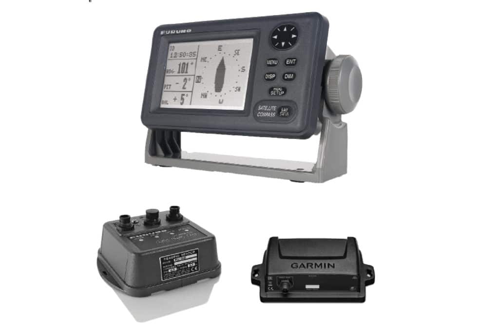
If there’s no smoking gun, wise navigators begin trusting their equipment in a descending order. The experts suggest it might go something like this: Commercial-grade satellite compasses (such as Furuno’s SC-50, which sells for right around $5,000) that use multiple internal GPS receivers to triangulate highly accurate heading information or gyrocompasses top the list, followed by GPS-derived COG information, then the ball compass, then the fluxgate or solid-state compass, then handheld compasses, then smartphones and tablets.
Still, says Josephson, it’s important to remember that if you really step in soup, you can always employ dead reckoning. He cites the example of a Seattle-based boat that rolled and dismasted en route home from Hawaii. The solution? They jury-rigged and sailed east. “It’s a big piece of beach,” says Josephson.
So while most sailors don’t need to swing their compasses annually, it’s important to periodically check your heading information, especially when new equipment or provisions are added. Moreover, it’s important for everyone to know where the compasses reside to ensure that an overzealous 10-year-old (ahem) doesn’t stow a toolbox in the wrong locker.
– – –
David Schmidt is CW’s electronics editor.

