Leave it to marine-electronics manufacturers to come up with some very good reasons for sailors to leave their couches, marina slips, ski condos or golf lodges this winter and head to a nearby boat show to see what’s new for 2019.
On a reconnaissance patrol of last fall’s boat shows and in discussions with manufacturers, it became clear that few in the industry have taken a holiday in terms of innovation. A couple of the more compelling reasons I found for sailors to get out their checkbooks involved devices designed to greatly enhance situational awareness at sea and give a skipper the ability to control a vessel from anywhere on board.
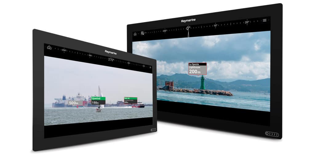
Let’s start with Raymarine’s new ClearCruise AR (pictured above), which delivers entirely new levels of collision avoidance and situational awareness, and is compatible with the company’s line of Axiom chart plotters. AR stands for augmented reality — in this case, the technology lets a user overlay critical navigational information on video imagery collected in real time.
This system requires three pieces of hardware: a Raymarine Axiom-series chart plotter ($850 to $12,300) that’s running Raymarine’s Lighthouse 3.7 or newer operating system; a Raymarine AR200 augmented reality sensor module ($500); and either a Raymarine CAM210IP ($700) or CAM220IP ($500) video camera.
The camera delivers a live video stream to the Axiom plotter, which ClearCruise AR enhances. For example, AIS-equipped vessels that appear in the video feed are displayed with graphical tags that denote their name and their distance away, data that’s gleaned from the boat’s networked AIS data. The system can also identify and graphically depict aids to navigation and user-created waypoints; a graphical azimuth banner ring delivers compass information. All data is updated in real time as a ClearCruise AR-equipped vessel and other nearby traffic move.
While ClearCruise AR can specifically help cruising sailors better identify objects that might otherwise be obscured by sails or rigging, Raymarine further enriched it by adding roll correction. The AR200 is fitted with a satellite receiver and a nine-axis attitude heading reference system (AHRS, the same technology used in drones and smartphones) that constantly measures and corrects for the vessel’s heading, pitch, roll and yaw. This means ClearCruise AR’s video imagery always displays a level horizon, irrespective of the boat’s heel angle or the surrounding sea state, and that AR tags remain graphically connected to their intended targets.
As with all things screen-related, bigger glass enables users to easily operate in split-screen mode, with the ClearCruise AR feed on one side and a chart plotter with AIS and radar overlay on the other. This allows users to comfortably spot a converging vessel using ClearCruise AR and then tap its corresponding AIS target on the chart-plotter screen to get its full navigation data.
At present, ClearCruise AR is only compatible with Raymarine CAM210IP or CAM220IP video cameras. But given that FLIR owns Raymarine, it’s highly likely that ClearCruiseAR will eventually be able to use FLIR’s thermal-imaging cameras instead of (or in conjunction with) Raymarine’s cameras. Additionally, it’s also possible that ClearCruise AR will eventually be able to work with other sensors, such as Doppler-enabled radar or even drone-mounted video cameras (Raymarine users can control compatible drones using their Axiom plotters).
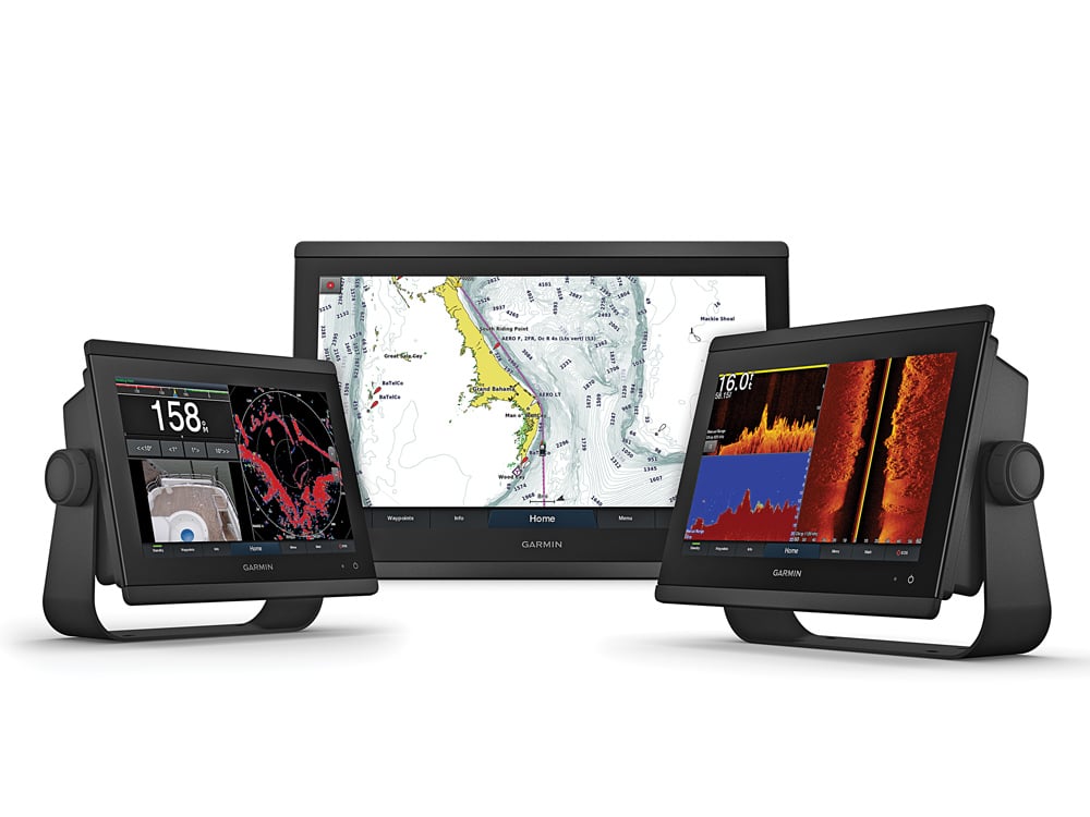
In a word, Garmin’s big news is cartography, both in terms of the hardware that displays it and the media itself. In late 2017, Garmin purchased Navionics, but spent its first year of ownership operating with a strict firewall between Navionics’ cartography and Garmin’s proprietary BlueCharts. This has now changed with the advent of BlueChart g3 cartography, which is a blend of the best of Garmin and Navionics’ bathymetry data and feature sets, and which works on Garmin plotters (non-Garmin customers can still buy Navionics cartography). All new Garmin GPSMap plotters are now shipping with BlueChart g3 as their base maps, and existing customers with Garmin chart plotters that are compatible with Garmin’s g2 HD charts will be able to upgrade to g3 cartography (see garmin.com for details). BlueChart g3 includes Garmin’s Auto Guidance. This innovative cartography feature allows a compatible chart plotter to use the electronic chart to automatically create a route based on user-stipulated parameters, such as the vessel’s air and water draft.
When it comes to hardware, Garmin’s new displays are an extension of the flagship GPSMap 8600-series chart plotters. They come in three new sizes, with 10-, 12- or 16-inch screens: the GPSMap 8610xvs ($2,700), the GPSMap 8612xvs ($4,000) and the GPSMap 8616xvs ($6,000). These displays have edge-to-edge glass, pinch-to-zoom touchscreen interfaces, IPX7 waterproof ratings, NMEA 0183 and NMEA 2000 connectivity, dual SD card slots, and high-resolution, optically bonded screens with in-plane switching for full sunlight readability at almost any angle. Additionally, these plotters come with Garmin’s SailAssist features, built-in sonar (a 1 kW traditional sonar and a 1 kW chirp sounder) and a fast processor that can simultaneously support up to four video-camera streams as well as HTML 5, which allows the plotters to play nicely with modern Web-based apps and wireless devices. It also makes it easier for the plotter to control third-party instrumentation or systems.
Garmin also unveiled its Reactor Autopilot Remote controller. This sleek, wireless remote is capable of controlling compatible Garmin autopilots from anywhere aboard the boat. Once networked, cruisers can just point and shoot the autopilot remote ($250) in any direction and the vessel will sail a corresponding course.
There’s little question that today’s radars, which feature technologies such as solid-state power amplifiers, pulse-compression and Doppler processing, afford sailors significantly better situational awareness. B&G’s new Halo24 ($2,700) radome-enclosed radar is B&G’s first radar to include Doppler processing (VelocityTrack in B&G parlance), giving B&G-equipped sailors the same kind of situational awareness that Navico (B&G’s parent company) has been supplying to the powerboating market with its Halo open-array radars. Halo24 radars, which offer coverage up to 48 nautical miles out, can simultaneously process multiple ranges, giving users B&G’s instant Dual Range performance. The system’s Doppler processing automatically color codes targets based on their threat level (dangerous targets are painted red on screen, while nonthreatening targets are visually de-emphasized). Navigators can also employ the Halo24’s mini automatic radar plotting aid functionality to track up to 10 user-specified targets at each range (for a total of 20 MARPA targets).
The Halo24 spins at 60 rpm at ranges up to 1.5 nautical miles — rather than its standard 48 rpm for greater ranges — to deliver near-real-time imagery at close ranges. Finally, the Halo24 offers four operating modes (harbor, offshore, weather and birds, with the latter designed to help anglers find fish). The 24-inch-wide dome boasts a lightweight design (14.9 pounds) that helps owners reduce weight aloft.
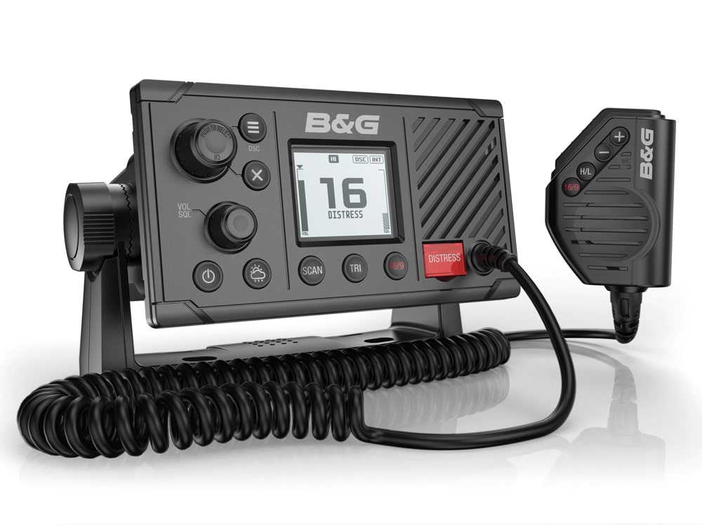
Also new from B&G is the V60 fixed-mount VHF radio, which delivers a dual-channel automatic information system receiver, an integrated GPS receiver, and NMEA 0183 and NMEA 2000 connectivity. The V60 ($619) also features a generously sized dot-matrix LCD screen, a dedicated man-overboard function and the ability to pair up to two H60 wireless handsets ($220).
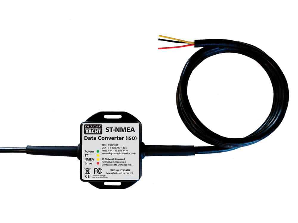
Digital Yacht has come up with a solution to a hardware problem that has proved vexing to owners of sailboats with older Autohelm and Raymarine instruments that still need to provide data to more modern gear. Autohelm first developed the SeaTalk network in the 1990s to let its autopilots access data from other onboard instrumentation. SeaTalk remained in use in most Autohelm and Raymarine products until 2012, when Raymarine stopped using the data protocol. The result, of course, is that a lot of sailboats are equipped with older instrumentation that, while functional, is hard to network with modern marine electronics, PCs or wireless devices, given that Raymarine no longer builds a gateway. Digital Yacht’s SeaTalk to NMEA gateway ($200) delivers bidirectional data conversions between a SeaTalk network and a NMEA 0183 device or network. Two versions of this converter exist, the ST-NMEA data converter (USB), which directly connects with a PC via a USB cable, and the ST-NMEA data converter (ISO), which allows the gateway to be networked with Digital Yacht’s wireless NMEA server ($200) and connect to wireless devices.
Digital Yacht also released its AIT5000 ($1,200) Class B AIS transceiver, which listens to both Class A and Class B AIS broadcasts and transmits its own Class B SO navigational data at 5 watts, which increases the AIS device’s position-reporting rates with vessel speed to ensure that the boat doesn’t outpace its displayed target. The AIT5000 comes with dual NMEA 0183 and single NMEA 2000 and USB interfaces, built-in Wi-Fi connectivity and an optional AIS man-overboard alarm, and it can be networked to Digital Yacht’s SeaTalk gateways.
While fluxgate compasses and nine-axis compasses can deliver heading data to a sailboat’s networked navigation system, Furuno’s satellite compass, the SC33, offers a faster, more accurate alternative. The solid-state SC33 ($2,600) uses dual in-line satellite receivers that are situated 1 foot apart, and calculates the slight time difference (measured in billionths of a second) between when the two antennas receive signals to determine the vessel’s heading. The SC33 has a three-axis rate gyroscope, acceleration sensors, a thermometer, a barometer, and a microprocessor to deliver heading, roll and pitch data that’s accurate to .4 of a degree, plus position data that’s good to 10 feet.
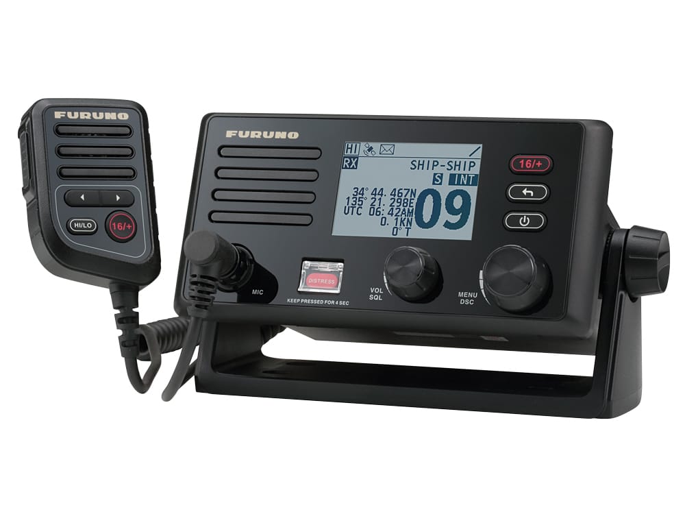
On the communications front, Furuno also released a fixed-mount VHF radio, the FM4800, which it’s billing as a “marine-electronics multitool.” As such, the 25-watt FM4800 ($750) comes with built-in digital selective calling, a 72-channel GPS receiver, an AIS receiver and a 15-watt loudhailer that includes eight different sound alerts for foggy conditions. The FM4800 is designed to network with Furuno’s NavNet TZtouch or NavNet TZtouch2 chart plotters, or users can alternatively share the FM4800’s AIS, DSC and GPS data with other networked instrumentation via the radio’s NMEA 0183 or NMEA 2000 connection.
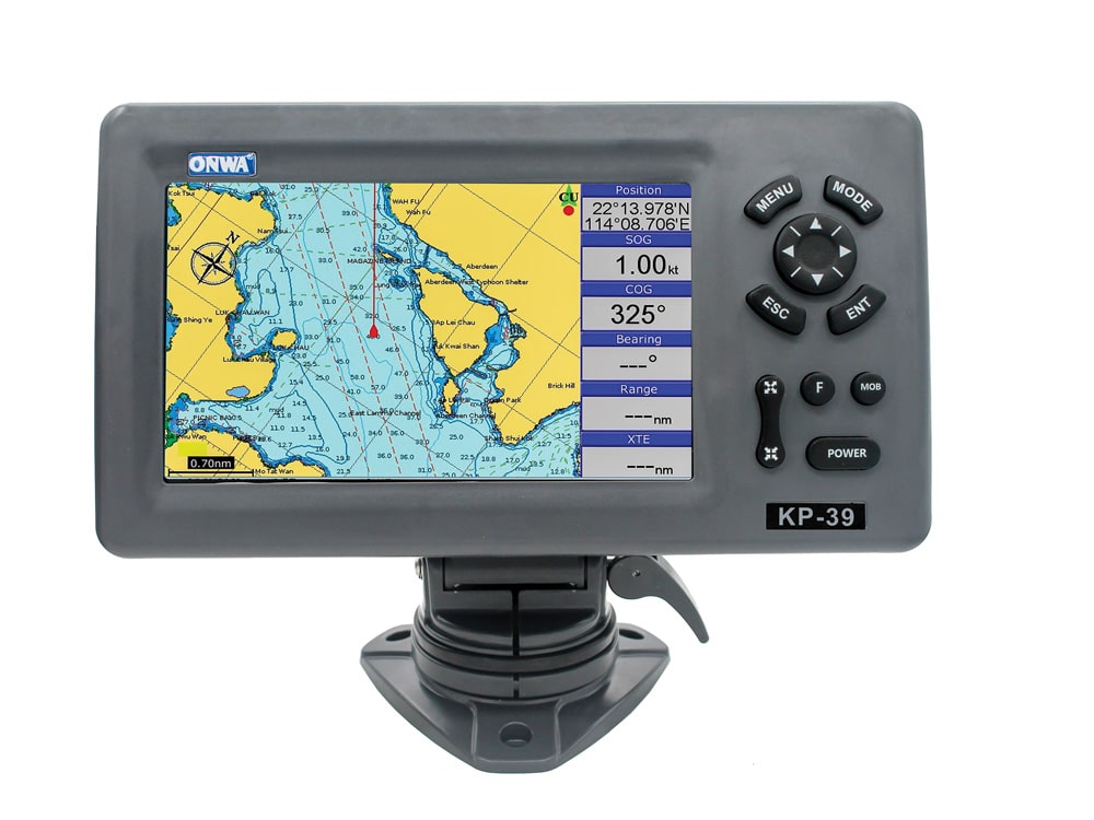
If you’re seeking an easy-to-use, GPS-enabled chart plotter that also offers AIS capabilities, ONWA‘s new KP-39A could be your ticket. The KP-39A ($340) uses a 50-channel GPS receiver plus a 7-inch color LCD display and a Class B AIS transponder. This NMEA 0183-compatable plotter can store up to 1,200 waypoints and 30 routes, and comes preloaded with ONWA’s proprietary K-chart base map and slots for external C-Map Max cartography. The plotter has IPX5 weatherproof protection and various onboard alarms, including audible warnings for cross-track error, AIS and anchor drift. The KP-39A ships with an external GPS antenna and a 13-foot cable.
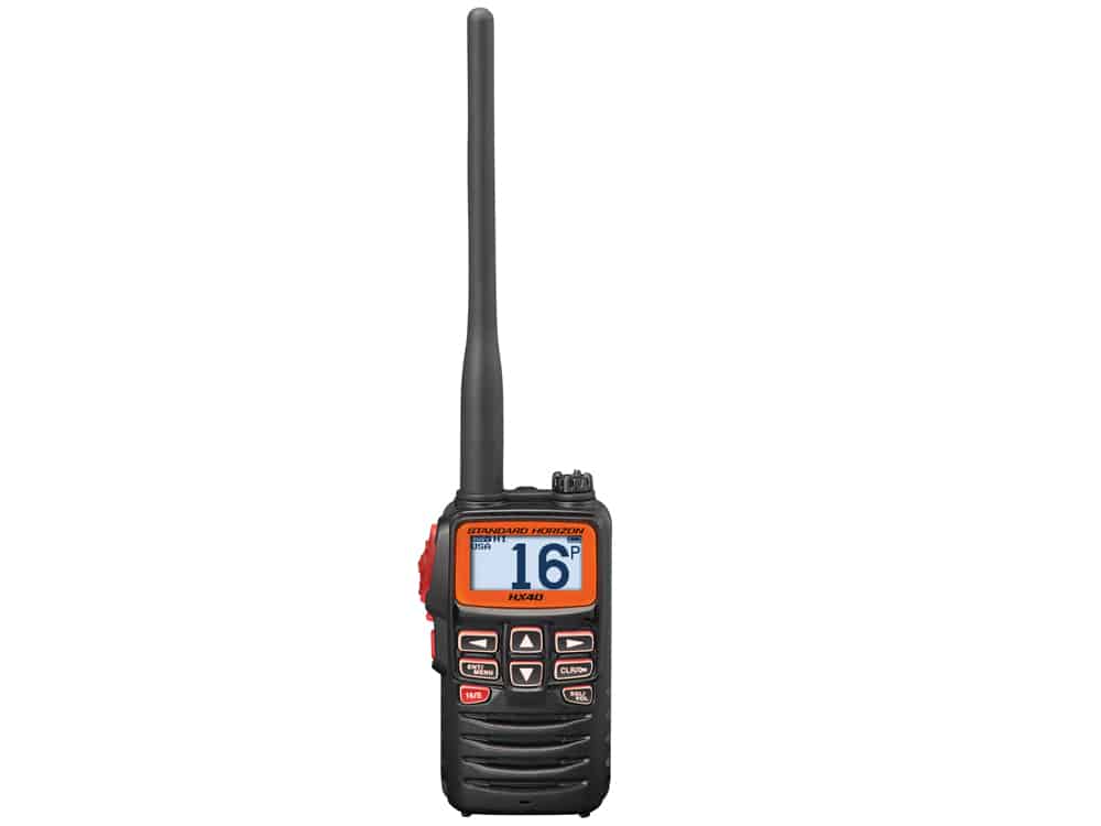
Aside from display screens, smaller is almost always better when it comes to marine electronics, and Standard Horizon‘s HX40 handheld VHF ($120) is diminutive indeed. The 6-watt radio measures just 2.05 inches wide by 3.74 inches high and 1.3 inches deep, and it weighs only 8.1 ounces. The radio can be made buoyant with Standard Horizon’s optional SHC-29 flotation case ($15). The HX40 features a preset key that allows users to quickly access up to 10 preselected channels, and has a lithium-polymer battery that delivers roughly 14 to 16 hours of operation between charges. Finally, the handheld sports a backlit display and access to NOAA weather.
For anyone seeking a bigger, more feature-rich handheld, Standard Horizon’s new HX890 ($269.99) is a floating 6-watt VHF with a 66-channel GPS receiver. The HX890 is built to military standards and comes with IPX8 weatherproof protection. It features a lithium-ion battery that delivers 11 hours of operating time. The HX890 also offers waypoint and route navigation, digital selective calling, access to NOAA weather channels, an FM radio receiver, a water-activated emergency strobe light, a 1.7-inch square dot-matrix display and a dedicated man-overboard feature.
David Schmidt is CW’s electronics editor.
Manufacturer Contacts
B&G
603-324-2042
Digital Yacht: digitalyachtamerica.com
978-277-1234
Furuno
360-834-9300
Garmin
800-800-1020
ONWA
+852 2557 8166
Raymarine
603-324-7900
Standard Horizon
800-767-2450

